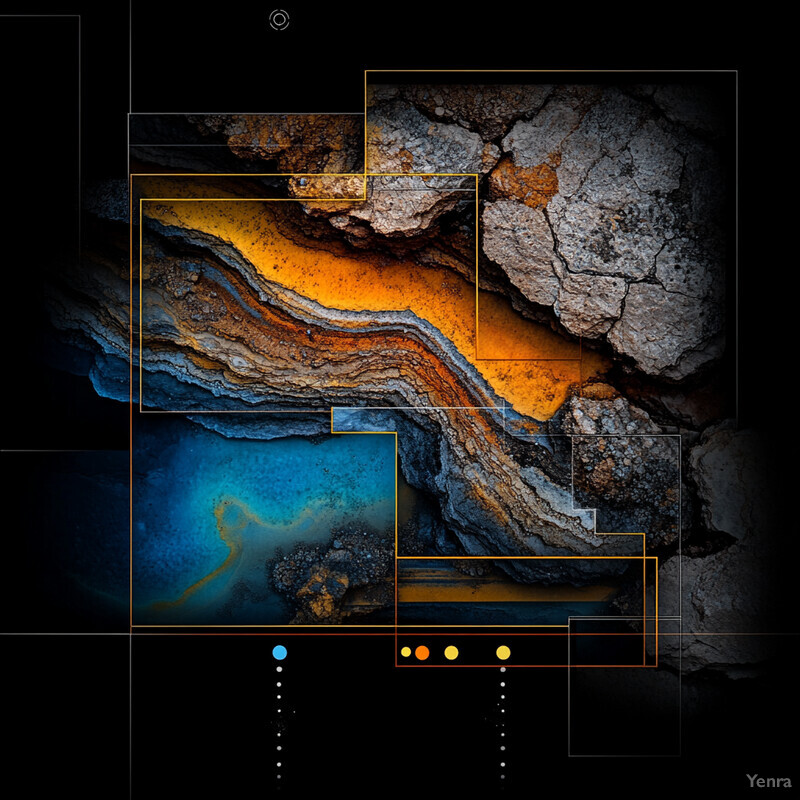
Mining exploration AI is strongest when it reduces search space and makes uncertainty more explicit. The best systems do not pretend to discover ore by magic. They combine GIS, remote sensing, geophysics, geochemistry, core imagery, and probabilistic modeling so teams can decide where to drill, where not to drill, and how much confidence to place in the model.
That matters because exploration is still constrained by time, access, and capital. A modern program may have decades of legacy reports, fresh satellite or airborne data, a growing archive of core images, and only a limited number of holes it can afford to test. AI is useful here when it helps geologists integrate those layers faster, reject weak ground sooner, and tighten the loop between new observations and the next decision.
This update reflects the category as of March 19, 2026. It focuses on the parts of the market that feel most grounded now: data integration, multiphysics interpretation, prospectivity mapping, core logging, adaptive drill planning, hyperspectral mineral mapping, uncertainty-aware targeting, legacy-data rescue, and more automated resource estimation workflows.
1. Geological Data Integration Across Drilling, Maps, and Geophysics
The practical value of AI often starts with integration. Exploration teams need drillholes, assays, maps, geophysics, and historical interpretations to work inside one spatial reasoning environment rather than as disconnected files and specialist handoffs.

A 2024 Geosciences paper used domain adaptation to transfer learning from drilling data to unlabeled geophysical data for mineral exploration, showing that models can bridge very different data domains instead of treating them as separate workflows. A 2025 Earth-Science Reviews paper argues that the future of mining AI depends on coupling geological knowledge with these integrated data systems rather than relying on isolated algorithms. Inference: integration is becoming an exploration advantage in its own right, not just a preprocessing step.
2. Advanced Geophysical Interpretation
Geophysical AI is getting stronger when it treats magnetics, electromagnetics, tomography, gravity, and structural context as one multiphysics targeting problem. That is more useful than a model that only highlights isolated anomalies with no geological explanation.

A 2024 arXiv paper combined ambient noise tomography with AI and showed that a continent-scale copper prospectivity model could be fine-tuned with relatively few local orebody intercepts to estimate the Hillside deposit outline. Fleet Space's 2025 real-time MT announcement also describes combining magnetotellurics with AI-powered interpretation to deliver 3D subsurface insights in days, while integrating with ambient noise tomography, active seismic, and gravity workflows. Inference: geophysical interpretation is moving from slow expert synthesis to faster, iterative targeting loops.
3. Faster Mineral Targeting
Target generation is one of the clearest commercial uses for AI in exploration. Teams want to move from a very large search area to a smaller number of drillable targets without waiting months for manual reinterpretation of every layer.
VRIFY says its DORA platform synthesized more than 170,000 historical and modern data points for RUA GOLD, and the company's April 2025 drilling then intersected near-surface high-grade gold along what it describes as a 2 km structural zone. Meanwhile, a 2025 Minerals review found that exploration target selection appears in more than half of the machine-learning mineral-prediction literature. Inference: faster target generation is becoming the most mature bridge between mining AI research and real exploration campaigns.
4. Predictive Resource Modeling
Resource prediction gets stronger when AI is used as a geology-aware complement to geostatistics rather than a total replacement. The real goal is not novelty for its own sake, but better forecasts of orebody continuity, tonnage, and likely grade behavior under sparse sampling.

A 2025 Minerals comparison on iron-ore grade estimation reported that random forest regression reached test-set R2 of 0.74 with RMSE of 2.06, essentially matching ordinary kriging at R2 of 0.74 and RMSE of 2.09. A 2024 Mining, Metallurgy & Exploration paper on Fe-grade estimation with XGBoost also framed machine learning as a practical alternative when variogram modeling and anisotropy handling become difficult. Inference: predictive resource modeling is becoming less about replacing geostatistics wholesale and more about selecting the right estimator for the orebody and data density at hand.
5. Machine Vision in Core Logging
Core photography is becoming a quantitative exploration signal. Once AI can classify formation, estimate mineral content, and isolate trays, gaps, and damaged sections consistently, core images stop being a passive archive and start acting like structured geological data.

A 2024 Swiss Journal of Geosciences study reported 96.7% accuracy for classifying 1 cm drill-core segments into formation classes, while also training CNN models to estimate silicate, clay, and carbonate content directly from images. A 2025 review of machine learning for drill-core image analysis also argues that the field is moving toward automated, context-aware logging but still benefits from human-in-the-loop review. Inference: computer vision is becoming a credible first-pass logging layer for large drilling programs.
6. Intelligent Drilling Guidance
Drilling guidance gets stronger when AI can update the exploration plan as evidence changes. That means not only steering around barren intervals, but also recognizing when the working geological hypothesis itself is probably wrong and should be revised before more capital is spent.

The 2024 preprint Intelligent Prospector v2.0 explicitly frames exploration drilling as planning under epistemic model uncertainty and reports that the system can detect early when all human-formulated hypotheses are likely wrong. A 2025 Journal of Geochemical Exploration paper also showed a near-real-time workflow for detecting regolith and basement boundaries from geochemical, spectral, and petrophysical drill data, including intervals where shorter sampling would be warranted. Inference: drilling guidance is shifting toward adaptive decision support that reacts to uncertainty instead of simply following a fixed grid.
7. Enhanced Grade Estimation
Grade estimation becomes more useful when AI can learn from denser operational data streams than traditional resource workflows usually exploit. That is especially relevant when blast-hole or measure-while-drilling datasets are much larger than the exploration dataset that seeded the initial model.

A 2025 Minerals case study on measure-while-drilling data analyzed 75,470 blast holes covering 844,855 meters and found that ensemble and Gaussian-process models could predict several geophysical signatures with R2 values up to 0.98. The authors note these predictions help infer lithology and orebody boundaries from dense operational drilling. Inference: AI grade estimation is becoming more powerful where operational drill density is high enough to support short-cycle learning.
8. Geochemical Anomaly Detection
Geochemical AI is most useful when it can recognize multi-element patterns that do not stand out on any single threshold map. That makes it valuable for covered terranes, regolith-dominated settings, and early-stage programs where the signal is weak and dispersed.
A 2024 Journal of Geochemical Exploration study in Western Australia used k-means clustering and singularity analysis on laterite geochemistry and reported that the resulting anomaly classes correctly captured known copper and nickel prospects and mines across different threshold levels. A 2026 benchmark paper, GeoChemAD, argues that unsupervised geochemical anomaly detection now needs standardized comparisons rather than isolated one-off case studies. Inference: geochemical anomaly detection is moving from artisanal tuning toward more reproducible evaluation.
9. Seismic and Wavefield Attribute Extraction
Wavefield data becomes much more useful when AI can extract prospectivity-relevant attributes quickly enough to guide follow-up work. In mineral exploration that often means learning from tomographic, MT, and other subsurface signals that are informative but too slow to interpret manually at scale.
The 2024 ambient-noise-tomography paper demonstrated that AI can refine a continent-scale prospectivity model at deposit scale using local high-resolution wavefield data and relatively few ore intercepts. Fleet's 2025 real-time MT release frames the same trend from the field side: geophysical signal extraction is becoming fast enough to affect active targeting programs instead of only retrospective interpretation. Inference: wavefield interpretation is turning into a more iterative exploration surface.
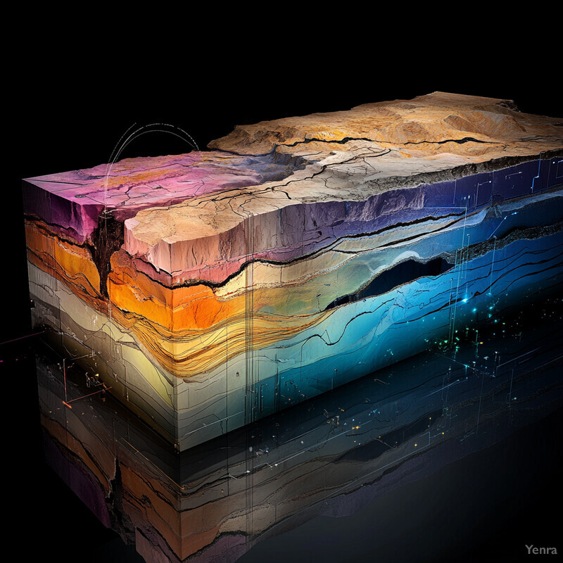
10. Improved Geological Domain Modeling
Geological domains become more useful when their boundaries are inferred from multiple evidence streams instead of being hand-drawn once and left static. AI helps by detecting transitions in drill data, topography, maps, and structure that would otherwise be easy to miss or hard to update consistently.
The 2025 Journal of Geochemical Exploration study on drill-core boundary detection found that feature-selected machine learning plus wavelet tessellation identified more detailed zonation and subtle lithological boundaries than visual logging alone. GEOMAPLEARN 1.2, published in 2025, also showed that both unsupervised clustering and supervised U-Net workflows can identify folds from geological maps and DEMs on real datasets. Inference: domain modeling is becoming more automated at both drillhole scale and map scale.
11. Rapid Hyperspectral Image Analysis
Hyperspectral exploration becomes much stronger when AI can do more than map obvious alteration minerals. The leading edge is using hyperspectral imaging to predict petrophysical properties, recognize alteration systems, and rank follow-up targets across large areas.
A 2025 Solid Earth paper showed that combined VNIR-SWIR-MWIR-LWIR hyperspectral drill-core data can predict slowness, density, and gamma response at millimeter-scale resolution. A 2024 Economic Geology study used 166-band ZY1-02D spaceborne hyperspectral data to map alteration minerals over roughly 8,000 square kilometers, identify 23 new porphyry copper targets, and confirm Cu-Au mineralization in all inspected field sites. Inference: hyperspectral AI is moving from mineral identification toward exploration-scale decision support.
12. Optimized Resource Estimation Workflows
AI matters at workflow level, not just model level. Exploration and resource teams need faster cleaning, validation, ranking, and handoff across many steps, with fewer manual breaks between raw data, geological interpretation, and reporting.

The 2025 Earth-Science Reviews paper organizes mining AI into 10 major exploration and estimation tasks, from data mining to grade and tonnage prediction, underscoring how broad the workflow has become. The 2025 Minerals review then counted 255 publications from 2016 to 2025 and found case studies now make up 32.75% of the literature, signaling a shift from concept papers toward real implementations. Inference: optimized workflows are becoming as important as individual prediction accuracy.
13. Drillhole Spacing Optimization
Drill spacing should respond to information value, not habit. AI helps estimate where another hole or a tighter interval will reduce uncertainty meaningfully, and where additional drilling is probably redundant.

Intelligent Prospector v2.0 is explicitly built to plan drillholes under uncertainty by updating the plausible geological scenarios as new information arrives. The 2025 boundary-detection study also highlighted specific intervals where shorter core sampling would improve the chance of detecting mineralization. Inference: AI can help justify where drilling should tighten, where it can relax, and where the current conceptual model is not worth densifying yet.
14. Real-Time Sensor Data Analysis
Exploration programs become more adaptive when downhole and drilling signals are analyzed fast enough to update the geological picture during the campaign. That includes measure-while-drilling, petrophysical logs, portable spectral systems, and other near-real-time feeds.

The 2025 measure-while-drilling study processed data sampled every 0.01 m across tens of thousands of blast holes and showed that machine learning can estimate several geophysical parameters from the drill stream with high fidelity. The 2025 regolith-boundary paper likewise emphasized near-real-time knowledge feedback during exploration drilling campaigns. Inference: real-time sensor analytics are turning drilling into a live geological observation process rather than a purely retrospective one.
15. Reduced Exploratory Risk
AI reduces risk mainly by ranking and rejecting ground more intelligently. Exploration teams do not just need more confidence in a positive target; they also need earlier evidence that a prospect lacks the structural or alteration context worth further spend.

A 2025 Frontiers in Earth Science paper on copper targeting in the Kolwezi district reported 85% classification accuracy and AUC values around 0.83 using random-forest modeling with geophysical, topographic, remote-sensing, and lineament inputs. The authors also found strong spatial correlations above 75% between mapped lineament density, geophysical anomalies, and predicted prospectivity. Inference: risk reduction comes from combining structural and alteration evidence in one prospectivity surface, not from any single anomaly map.
16. Uncertainty Quantification
Prospectivity maps are much more useful when they show uncertainty alongside probability. Exploration decisions are capital-allocation decisions, so teams need to know where the model is confident, where it is extrapolating, and where more drilling would change the answer most.

Intelligent Prospector v2.0 is explicitly built around epistemic uncertainty and multiple plausible orebody scenarios. A 2025 Natural Resources Research paper introduced a Dirichlet-based uncertainty-aware deep-learning framework for explainable mineral prospectivity mapping, coupling uncertainty outputs with SHAP-style interpretation. Inference: uncertainty-aware targeting is becoming a core exploration requirement rather than an academic add-on.
17. Integration of Legacy Data
Legacy reports, maps, and scans are becoming productive exploration assets again once AI can georeference, extract features, and connect them to modern spatial layers. This is especially important in mature districts where the most valuable data may already exist but is trapped in old formats.

A 2025 USGS publication on the Artificial Intelligence for Critical Mineral Assessment Competition reported median RMSE of 1.1 km for automated georeferencing and median F1 scores of 0.77, 0.56, and 0.35 for prompted extraction of polygons, polylines, and points from historical geologic maps. In Western Australia, the 2023-24 DEMIRS annual report says more than 85% of the 122,000 reports and associated datasets in WAMEX are now available through the new search interface and GeoView application. Inference: legacy-data rescue is shifting from a manual archival exercise into a scalable exploration-data pipeline.
18. Structural Geology Analysis
Structure still matters because many ore systems are controlled by faults, folds, corridors, and intersections. AI helps by extracting these patterns more consistently from maps, DEMs, remote sensing, and regional prospectivity data than purely manual interpretation can sustain at scale.
GEOMAPLEARN 1.2 showed in 2025 that machine learning can detect folds from geological maps using both unsupervised clustering and supervised CNN workflows. The 2025 Frontiers copper-targeting study in the DRC also found that predicted high-potential zones correlated strongly with lineament density and major structural orientations consistent with regional tectonics. Inference: structural geology is becoming one of the most valuable ways to connect remote data to drillable targets.
19. Automated Classification of Rock Types
Rock classification is expanding beyond thin sections and manual field calls. AI can now support lithology recognition across UAV outcrops, core trays, microscope imagery, and other image streams, making classification faster and more consistent across a campaign.
A 2025 Drones paper that combined UAV oblique photogrammetry with a channel-attention DeepLabV3+ workflow reported overall lithological-classification accuracy of 97.95% and mean intersection over union of 95.71%. The 2024 Swiss drill-core study reached 96.7% accuracy for formation classification from core imagery. Inference: automated rock-type classification now spans both outcrop-scale and core-scale image interpretation.
20. Continuous Improvement via Feedback Loops
The most valuable exploration AI systems are not static maps delivered once. They improve as new drilling, assays, field checks, and reinterpretations arrive, which lets the targeting system and the human team learn together over time.
VRIFY's RUA GOLD case describes an active loop in which initial AI-ranked targets were drilled, early results validated the target, and six additional AI-validated holes were then planned along the corridor. At public-infrastructure scale, the USGS AI4CMA data release was explicitly published so georeferencing and feature-extraction tools could continue improving after the original competition. Inference: the strongest exploration AI programs are becoming closed-loop systems with ongoing retraining and validation, not one-time model drops.
Related AI Glossary
- Geographic Information System (GIS) explains how exploration evidence is organized, layered, and compared spatially.
- Remote Sensing covers satellite, airborne, and drone measurements used to scan large areas before drilling.
- Hyperspectral Imaging explains how narrow spectral bands help identify alteration minerals and lithology.
- Photogrammetry covers UAV and image-based 3D reconstruction for outcrops, pits, and structural mapping.
- Change Detection helps explain how repeated imagery or surveys reveal movement, disturbance, or evolving field conditions.
- Anomaly Detection shows how AI finds unusual geochemical or geophysical patterns worth investigation.
- Surrogate Model explains how faster proxy models can help shrink drilling and scenario-testing cycles.
- Digital Twin adds the idea of a live geological or operational model that updates as new field data arrives.
Sources and 2026 References
- Geosciences: Domain Adaptation from Drilling to Geophysical Data for Mineral Exploration.
- Earth-Science Reviews: Artificial intelligence and machine learning in mining and mineral exploration.
- arXiv: End-to-End Mineral Exploration with Artificial Intelligence and Ambient Noise Tomography.
- Fleet Space: Real-time MT for mineral exploration.
- VRIFY: RUA GOLD Reports High-Grade Intercepts From AI Targets.
- Minerals: Advancing Iron Ore Grade Estimation.
- Mining, Metallurgy & Exploration: Estimation of Fe Grade Using XGBoost.
- Swiss Journal of Geosciences: Direct mineral content prediction from drill core images.
- Ore Geology Reviews: Machine learning for drill core image analysis in geosciences.
- arXiv: Intelligent Prospector v2.0.
- Minerals: Measure-while-drilling data and machine learning case study.
- Journal of Geochemical Exploration: Rapid analysis of drill core data for geological boundaries.
- Journal of Geochemical Exploration: Laterite geochemical anomaly identification in Western Australia.
- arXiv: GeoChemAD.
- GMD: GEOMAPLEARN 1.2.
- Solid Earth: Predicting petrophysical properties from combined hyperspectral drill core data.
- Economic Geology: Alteration Mapping for Porphyry Cu Targeting Using ZY1-02D.
- Minerals: A decade review of machine learning in mineral prospectivity prediction.
- Frontiers in Earth Science: Copper targeting in the Kolwezi district.
- Natural Resources Research: Dirichlet-Based Uncertainty-Aware Deep Learning for Explainable Mineral Prospectivity Mapping.
- USGS: Lessons learned from the AI for Critical Mineral Assessment competition.
- USGS: Training and validation data from the AI for Critical Mineral Assessment Competition.
- USGS: Earth MRI Progress.
- DEMIRS annual report 2023-24.
- DMIRS Data and Software Centre: WAMEX.
- Drones: UAV Oblique Photogrammetry-Based Lithological Mapping with CA-DeepLabV3+.
Related Yenra Articles
- Chemical Analysis in Oil and Gas shows another extractive-industry workflow built on field sensing, interpretation, and model-guided decisions.
- Geospatial Analysis adds the spatial modeling layer behind exploration targeting and field planning.
- Aerial Imagery Land Management connects exploration to drone and airborne survey workflows.
- Environmental Monitoring adds the permitting, disturbance, and field-sensing context around modern exploration programs.
- Hazardous Material Detection broadens the materials-identification side of sensing and spectroscopy.