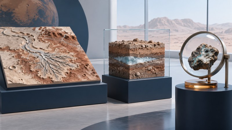
Mars has water ice today and a geological record of water acting on its surface in the past. Understanding a discovery means identifying the form of water, the place and time involved, and the observation that supports the claim.
A frozen deposit, a water-bearing mineral and an ancient river channel tell different stories. Each is valuable evidence, but each answers a different question about the planet. Use this guide to read the distinctions before drawing a conclusion about climate, life or resources.
First identify what “water” means
| Evidence | What it can establish | What needs more evidence |
|---|---|---|
| Water ice | Frozen water at a measured location or within an instrument's sensing volume. | Its full depth, purity, distribution and accessibility. |
| Water-related minerals | Composition consistent with water being bound in a mineral or involved in its formation or alteration. | When the water acted, its chemistry and the duration of the environment. |
| Channels, deltas and sedimentary layers | A record that can support transport and deposition by flowing water when interpreted with geological context. | Flow rates, duration, climate and alternative ways to produce particular features. |
| Dark or changing surface streaks | A visible change in surface appearance. | The cause of the change; dry dust or sand can produce flow-like patterns. |
| A modeled deep reservoir | An interpretation that fits selected measurements under specified assumptions. | Independent confirmation, uniqueness of the model and actual depth or volume. |
NASA's Mars facts describe the cold, thin-atmosphere environment and the planet's water history. Conditions vary with location and season, so keep the setting attached to a result.
How rocks record ancient rivers and lakes
Moving water can carry sediment, sort particles and deposit layers as its speed changes. A river entering a standing body of water may build a delta. On Mars, the strongest interpretations combine the larger landform with details of the deposits: their layering, relationships, composition and position within a basin.
At Jezero crater, Perseverance's views of the delta front and Kodiak butte added ground-level geometry to orbital observations. NASA's 2021 explanation of the delta evidence describes how detailed images of layers help reconstruct the crater's past environment. Layer thickness, particle size and the angles of beds each provide clues to that history.
Use the image-reading guide before comparing photographs. A close-up without scale or a processed color view without a legend can obscure the very relationships needed to assess a claim.
What present-day ice tells us
NASA's Phoenix mission directly investigated ice-rich ground at a northern landing site in 2008. Digging and sample analysis connected a surface observation with material beneath it. That is a different kind of evidence from recognizing an ancient river-shaped valley in an orbital photograph.
Orbital measurements extend coverage beyond a single landing site. Images can expose bright material in fresh excavations; spectroscopy and other instruments help identify composition, while radar or neutron measurements probe different physical properties and depths. Their interpretation depends on the instrument and the model used. Check the method before treating a colored map as a direct photograph of ice.
A local detection is valuable even when the surrounding deposit is incompletely mapped. For a possible exploration resource, the next questions concern depth, concentration, overlying material, terrain and the energy needed to reach and process it. “There is ice” begins that investigation.
Why claims about water flowing today need close reading
Some dark slope features were interpreted as possible liquid flows. Subsequent work tested dry mechanisms. NASA's 2017 account of recurring slope lineae describes slopes and behavior consistent with granular flows while noting unresolved questions.
A 2025 Brown University and University of Bern study used a global catalogue and environmental comparisons to favor dry dust-related explanations for slope streaks and recurring slope lineae. The useful lesson is methodological: test a visually persuasive idea against temperature, slope, season, dust and other independent information.
When reading a new report of subsurface liquid water, identify whether it is a direct material measurement or a model fitted to a geophysical signal. Ask which other materials or structures could produce a similar signal. Describe the finding at the confidence level supported by the research, with its publication date.
From water to habitability—and from detection to use
Life as we know it needs a suitable combination of water, energy and chemistry. An environment can be potentially habitable without preserving evidence that anything lived there. NASA's science objectives treat the search for life and the reconstruction of environments as connected investigations.
For human exploration, a different chain of reasoning is needed. A resource assessment must connect measured material to a practical recovery process. Ice mixed with soil, water bound in minerals and hypothetical deep liquid reservoirs imply very different machinery, energy and uncertainty. A colorful distribution map supplies an input to engineering; it leaves extraction performance to be demonstrated.
A quick way to assess the next headline
- Write the form: ice, molecular water, mineral-bound water, ancient landform or inferred liquid.
- Record the place and time: surface or subsurface; present material or evidence of an ancient process.
- Name the measurement: image, spectrum, sample, radar or another geophysical signal.
- Separate the result and interpretation: what was observed, and what explanation best fits it?
- Find the remaining question: amount, age, depth, origin, alternative mechanism or recoverability.
A useful one-sentence note is: “This instrument measured this feature at this site; the team interprets it this way, with these limits.” Save the supporting paper or mission record so a later result can be compared fairly.
Continue with how Mars exploration works, compare water on the Moon, or return to Space Exploration.