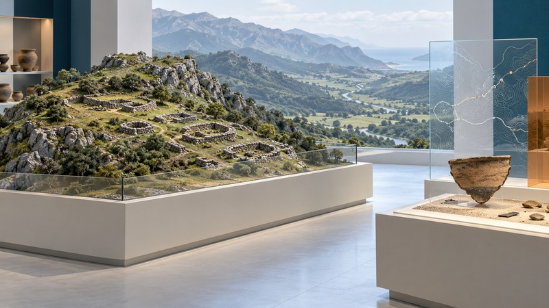
The Cantabri were communities of northern Iberia known largely through Greek and Roman accounts and the material remains of their region. Their history becomes clearer when three questions are kept separate: how outsiders described them, how Roman conquest changed the region, and what archaeology can establish about particular places.
A name recorded by outsiders
Begin with northern Iberia, around the Cantabrian mountain country. Ancient geographical names describe a different political landscape from today's Spanish administrative map. Use the modern region of Cantabria as an orientation point, then ask which ancient source or archaeological distribution supports a more precise boundary.
In Geography 3.3.7–8, Strabo includes the Cantabri among several northern peoples in a collective description of mountain life. He discusses food, drink and communal meals, then presents Roman rule as a force bringing order. That pairing reveals both his subject and his interpretive position: a writer viewing the region through an imperial framework.
Read each detail with its stated scope. A custom attributed to a broad group of northern mountain peoples provides a different kind of evidence from an observation tied to a named Cantabrian settlement. Strabo's account is valuable testimony about ancient descriptions of the region; his judgments need to remain attributed to him.
Conquest and the problem of identifying a camp
The campaigns conventionally grouped as the Cantabrian Wars span 29–19 BCE. Military archaeology can help locate the movement and temporary presence of Roman forces. A 2020 study by Víctor Vicente García reviews campaign camps and proposes El Juncal, between the Pas and Besaya valleys, as another example.
The study uses aerial imagery and terrain data to examine earthworks whose form resembles Roman camps. Its conclusion calls for field investigation to establish chronology and function more securely. This is a useful case of a reasoned identification awaiting further testing. The outline of an enclosure can support a hypothesis; excavated contexts and dated finds would strengthen the connection to a particular campaign.
Match the question to the evidence
| Evidence | Useful question | What to check next |
|---|---|---|
| Ancient written account | How does the author describe a people or a practice? | The passage's geographical scope, purpose and distance from the events. |
| Earthworks or settlement remains | What activity could explain this form and location? | Survey methods, excavation context, dating and alternative interpretations. |
| Museum reconstruction | How might excavated spaces have worked together? | Which features survive and which have been restored or inferred. |
A worked reading exercise: a claim about food
Suppose you are investigating a dietary practice mentioned in an ancient text. First record exactly whom the passage describes. Next identify material evidence that could test that claim: plant remains, animal bones, cooking vessels or residues from dated contexts. Finally compare the places and periods represented. Agreement would support a local interpretation; a mismatch would prompt questions about chronology, sampling or the writer's generalization. This is a research method, not a claim that a particular find has already confirmed Strabo.
Julióbriga shows a different historical moment
At Retortillo, near Reinosa, Julióbriga's official archaeological interpretation introduces urban life after the Roman conquest. Its principal period of growth falls in the first and second centuries CE. The site therefore helps a reader investigate life under Roman rule, alongside the earlier questions about military conflict.
The reconstructed Casa de los Morillos makes the rooms of a Roman house easier to understand. Read it together with the excavated foundations and the museum's objects: each contributes a different layer of explanation. A standing interpretive reconstruction visualizes a house, while surviving remains and their recorded contexts supply the evidence from which that visualization was developed.
For a useful set of notes, give each claim a place, an approximate period, a source and a confidence level. This keeps conquest, everyday life and later interpretation connected without compressing them into a single unchanging picture of the Cantabri. For a comparison of urban spaces and their functions, continue with the Roman Forum guide.
Explore more documents, places and interpretations in Yenra History.