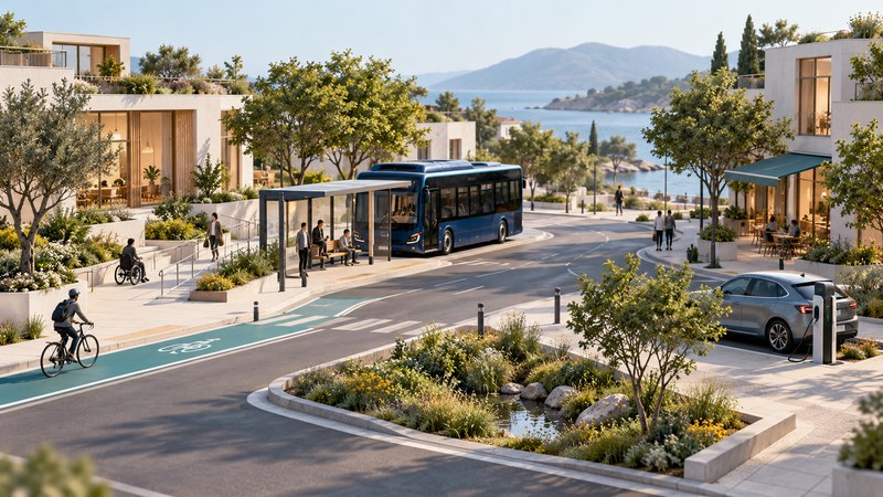
A community’s future is visible in the journeys people can make and the places they can reach. Useful change may come from a better crossing, reliable buses, housing near everyday destinations, charging where people park, or streets that remain comfortable in hotter weather.
Begin with a real journey or unmet need. Then examine the service, infrastructure and maintenance required to improve it. This works for a large city, a suburb or a smaller community where distances and travel options differ.
Start with access to a destination
Choose a common trip: work, school, groceries, a medical appointment or a social visit. Record its whole chain, including booking, walking to a stop, waiting, transfers, the final approach and the return. Check how the trip works at the times people actually need it.
Now consider someone with different constraints: a wheelchair user, a caregiver with a stroller, a person without a smartphone, or a worker whose shift ends after regular service. A faster vehicle helps only if the complete journey remains usable.
On a small screen, scroll the table sideways. Keyboard users can focus the table region and use the arrow keys.
| Measure | Why it matters | Useful local evidence |
|---|---|---|
| Door-to-door time | Includes waiting and transfers as well as motion. | Actual schedules, trip observations and missed-connection records. |
| Reliability | A service must work when people depend on it. | Cancelled trips, delay distributions and recovery arrangements. |
| Accessibility | Every part of the journey must be usable. | Accessible stops, crossings, vehicles, booking and assistance. |
| Affordability | Repeated trips can strain a household budget. | Fares, transfers, subscriptions and necessary companion costs. |
| Reach | A network’s value depends on the destinations it connects. | Hours of operation, service area and realistic return trips. |
Use the same definition before and after a change. Comparing a new vehicle’s best demonstration run with an old service’s worst day can obscure what ordinary users will experience.
Electric mobility depends on places and routines
The U.S. Alternative Fuels Data Center’s guidance on charging at multifamily housing describes building-level planning issues. For a resident, charging access can depend on permission, parking arrangements, electrical infrastructure and how costs are shared.
A community planning question is therefore broader than charger count. Ask where vehicles already dwell, who has access, how payment works, how faults are reported and who maintains the installation. Match the service to the user: overnight parking, a workday stop and a short intercity stop have different requirements.
Watch projects progress through funded plans, site work, connection, commissioning and sustained operation. A proposed location or announced grant indicates intent; functioning equipment with a clear service arrangement establishes something more useful.
Judge automated driving within its operating limits
NHTSA’s explanation of vehicle automation distinguishes driver assistance from systems that take on driving tasks under defined conditions. At Level 2, the driver remains responsible and attentive even when assistance handles steering and speed. A service operating without an onboard driver in a limited area presents a different capability and set of constraints.
For any proposed service, examine where it operates, weather and road limits, hours, passenger eligibility, accessibility and the response to breakdowns or unusual situations. Match claims to the exact service and operating conditions. A demonstration on one route provides no assurance about an untested route.
Watch for meaningful safety reporting, transparent operating boundaries and dependable assistance. Compare outcomes over relevant exposure and conditions. A raw count of incidents without distance, types of roads or reporting definitions can make comparisons misleading.
Housing, shade and drainage shape the same journey
Where housing and everyday destinations are placed affects the journeys a network must serve. A neighborhood with useful nearby destinations creates different possibilities from a dispersed area. In smaller communities, a dependable connection to a regional center may matter more than a dense local route network.
The EPA describes how trees and vegetation can help reduce heat islands and how green infrastructure can manage stormwater near where it falls. For a particular project, local climate, soils, drainage, plant survival and maintenance determine performance. Ask how the design will be maintained after the opening photograph.
A shaded route, usable crossing and accessible stop can reinforce one another. Planning them together helps prevent a technically impressive project from ending at an inaccessible curb or an uncomfortable final walk.
Follow a project from promise to operation
Over the next one to three years, inspect funded budgets, service contracts, accessible designs and maintenance responsibility. Over three to seven years, follow housing decisions, network connections and infrastructure completion. Treat longer-term automated or fully integrated services as possibilities whose enabling conditions must be demonstrated.
Find the actual local plan, meeting record, budget or operator documentation. Note its date and status: proposed, adopted, funded, under construction or operating. Keep your observations separate from official claims, and use public participation opportunities to ask a specific question about a real journey.
Continue exploring
- Connect mobility to household energy
- Compare options under uncertainty
- Explore transportation guides
- Explore the Future library
Evidence and links reviewed October 17, 2026. Future developments remain conditional on the evidence and circumstances described.