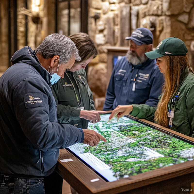
Natural habitat restoration gets stronger when practitioners can answer four practical questions early: what is actually on the ground, what has changed, what is likely to change next, and which interventions are most likely to hold up over time. AI is becoming useful here not as a replacement for field ecology, but as a way to digest more imagery, sensor data, and monitoring history than manual review can handle.
The strongest systems combine earth observation, remote sensing, change detection, computer vision, downscaling, and decision-support systems. That combination helps restoration teams map degraded land, choose seed sources, watch for stress, measure biodiversity return, and prioritize where limited crews and budgets should go first.
This update reflects the field as of March 17, 2026 and leans on USDA, USFS, NOAA, USGS, WDFW, NRCS, Wildlife Insights, SER, and recent peer-reviewed studies. Inference: the biggest gains are coming from better targeting, better monitoring, and better prioritization, not from fully autonomous restoration.
1. Precision Habitat Mapping
AI-based habitat mapping is strongest when it turns repeated imagery into actionably fine site intelligence. With modern earth observation and remote sensing, restoration teams can separate wetland edges, canopy gaps, erosion zones, and invasive patches at resolutions that support field crews rather than just presentation maps.
A 2023 Science of the Total Environment paper showed that convolutional neural networks could map wetlands from open multispectral and LiDAR data at 1 meter resolution. More recently, on July 14, 2025, Pew highlighted an AI-powered hidden-wetlands mapping tool being used to improve inventories and guide restoration priorities in places where wetlands are obscured by forest cover or incomplete legacy maps. Inference: the most valuable mapping systems are the ones that narrow where teams should validate in the field and intervene first.
2. Predictive Modeling of Ecosystem Change
Restoration planning fails when it assumes the future climate will look like the recent past. AI helps by using downscaling and probabilistic forecasting to translate coarse climate output into local heat, rainfall, and hydrologic context that is more relevant to real sites.

Two 2025 papers show where this field is moving. A Nature Machine Intelligence study presented fast, scale-adaptive, uncertainty-aware downscaling of Earth-system fields with generative machine learning, while an npj Climate and Atmospheric Science paper downscaled ERA5 precipitation to kilometer and sub-hourly scales. Inference: the practical gain for restoration is not abstract model novelty, but a better read on whether a wet meadow, forest edge, or floodplain reconnection project is likely to remain viable under local future conditions.
3. Optimizing Seed Selection
Seed sourcing is increasingly a climate-matching problem rather than a simple rule that local seed is always best. AI-assisted tools can compare seedlots, transfer zones, and future climate analogs so practitioners can choose plant material that is more likely to survive, reproduce, and stay adapted as conditions shift.

The USDA Climate Hubs Seedlot Selection Tool explicitly helps managers match planting materials with current or future climate conditions, while the US Forest Service Seed Zone WebMap provides provisional, climate-matched, and empirical seed zones for native plant restoration. Both tools are careful about their limits: they support decision-making, but they do not replace knowledge of soils, pests, disease pressure, and on-site ecology. Inference: the strongest seed-selection workflows use climate matching to reduce obvious maladaptation risk before any seedlings go in the ground.
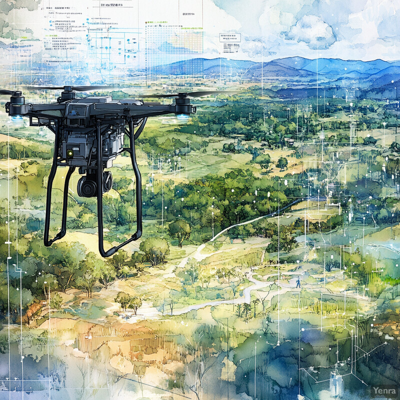
4. Drone-Assisted Reforestation
Drone-based restoration is strongest where it extends access and monitoring, not where it promises magical tree counts. AI helps drones survey terrain, identify accessible microsites, and revisit seeded areas after fire or flood, which is especially useful on steep, remote, or otherwise hazardous land.

A 2024 review of UAV-assisted seeding and monitoring concluded that drone use is growing fastest where terrain, distance, or post-disturbance conditions make conventional access difficult. A 2024 US Forest Service chapter on advances in forest restoration management makes the same ground-truth point from practice: drone seeding and aerial methods can help, but species choice, site preparation, and follow-up monitoring still determine whether restoration succeeds. Inference: the realistic near-term gain is better access, faster site assessment, and better post-planting monitoring rather than a full replacement for nursery and field operations.
5. Invasive Species Detection and Management
AI improves restoration when it spots invasive species before they dominate a site. In practice that usually means combining computer vision with repeated imagery or trap systems so crews can inspect and treat the highest-risk locations first.
The 2024 Communications Biology paper on VespAI showed how deep learning can automate invasive hornet detection from targeted imagery. On April 28, 2025, Purdue researchers described large-scale remote-sensing workflows for detecting invasive shrubs, with validation from regional forest managers. Inference: the strongest invasive-species systems are not fully automatic eradication systems; they are triage systems that make surveillance and removal crews much faster and more targeted.
6. Soil Health Monitoring
Soil is where many restorations quietly succeed or fail. AI is most useful when it combines field samples, moisture observations, carbon measurements, and terrain context to highlight compaction, drainage mismatch, or organic-matter deficits that would otherwise be easy to miss.

NRCS expanded its Soil Carbon Monitoring and Research Network in 2025 to gather field-based data on soil carbon trends tied to conservation practices, while the Soil Climate Analysis Network continues to provide automated soil and climate measurements that can anchor model interpretation in real conditions. Inference: soil AI is only as trustworthy as the measurements behind it, so the strongest restoration workflows use models to target sampling and track trends rather than to replace field observation.
7. Wildlife Population Tracking
Restoration outcomes should be measured by returning animals, not only by planted acres or seedling survival. AI helps by processing camera traps, aerial imagery, and other biodiversity signals at a scale that makes regular wildlife tracking practical.
Wildlife Insights has made AI a core part of camera-trap review, helping conservation teams process very large image collections that would otherwise sit in backlog. NOAA Fisheries is pushing a parallel frontier with Geospatial Artificial Intelligence for Animals, which uses overhead imagery to study animals from space. Inference: the practical restoration gain is faster feedback on occupancy, movement, and activity, with expert review focused on the observations that matter most.
8. Intelligent Corridor Planning
Restoring isolated patches is rarely enough if species still cannot move between them. AI and optimization help plan habitat connectivity across roads, farms, parcel boundaries, and climate gradients by evaluating movement, cost, and landscape structure together.

Washington's Habitat Connectivity Action Plan, published June 30, 2025, shows how connectivity planning is moving into implementation with road crossings, mapping priorities, and cross-agency coordination. On the research side, a Conservation Biology study on optimal budget-constrained multispecies corridor networks showed that joint optimization can preserve most species-specific ecological value at substantially lower cost than planning separate corridors one at a time. Inference: AI matters here because corridor planning is a constrained optimization problem, not just a cartography problem.
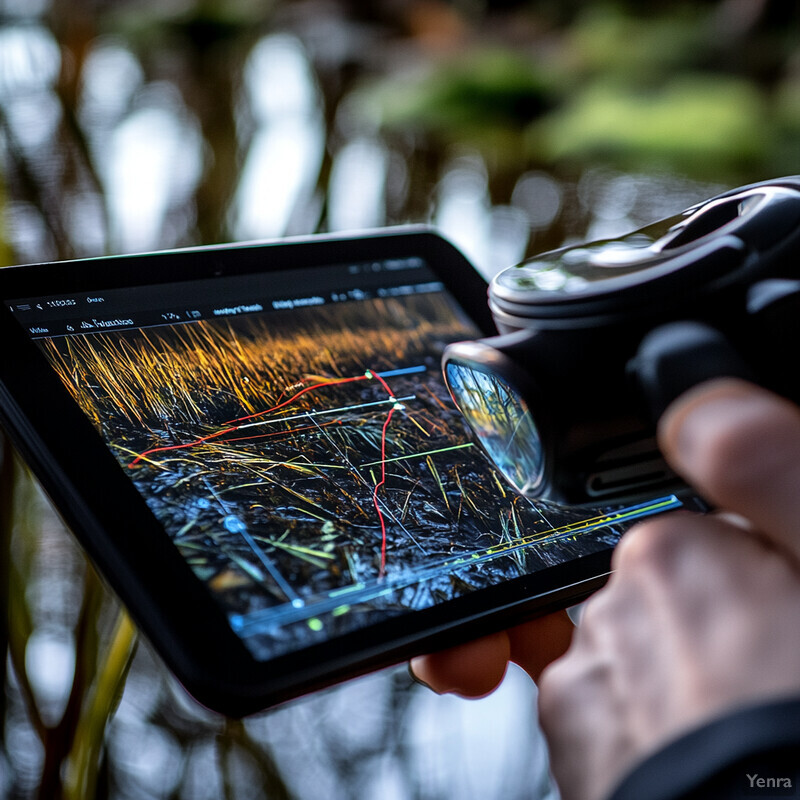
9. Adaptive Management Feedback Loops
Restoration is strongest when monitoring actually changes what crews do next. AI can help turn repeated field observations, sensor feeds, and imagery into a live decision-support system instead of a once-a-year reporting exercise.

NOAA's 2024 update to its Monitoring and Adaptive Management Manual shows how restoration programs are increasingly formalizing triggers, thresholds, and learning loops rather than treating monitoring as a compliance afterthought. A 2025 long-term evaluation of the Sun Island wetland in Northeast China reached the same conclusion from the field: adaptive management was critical to keeping restoration aligned with changing conditions over decades. Inference: AI is most useful when it shortens the path from new evidence to changed management actions, but only if projects define decision points in advance.
10. Climate-Resilience Modeling
Climate-smart restoration uses scenario testing rather than wishful thinking. AI helps stress-test designs against drought, flooding, wildfire, and sea-level change before projects are installed, which makes resilience modeling valuable both for site choice and for deciding what promises are realistic.

A 2025 Nature Geoscience paper estimated limited carbon sequestration potential from global ecosystem restoration, a useful corrective to overbroad assumptions about where restoration will remain productive under real constraints. Pair that with the 2025 generative downscaling work in Nature Machine Intelligence, and the direction is clear: better local climate translation plus more realistic biophysical ceilings produces stronger restoration planning than generic global targets alone. Inference: climate-resilience modeling earns its keep when it constrains project claims before money and labor are committed.
11. Ecosystem Service Valuation
AI can help estimate flood buffering, water quality improvement, carbon storage, recreation, and habitat benefits, but strong ecosystem-service valuation keeps assumptions visible. The best systems make tradeoffs legible rather than treating one dollar figure as the whole story.

USGS has highlighted ARIES for SEEA as an AI-assisted approach to ecosystem accounting, pointing toward more operational natural-capital workflows. USGS work in the Great Lakes coastal zone shows the complementary restoration side: decision tools and assessment frameworks are being built to connect restoration options with expected wetland function and regional benefits. Inference: valuation becomes most credible when it is attached to specific management choices and measured ecosystem functions, not just a generic estimate of nature's worth.
12. Species-Specific Restoration Strategies
The best restoration plans are often species-specific or guild-specific rather than generic revegetation templates. AI-assisted habitat-suitability models help tailor hydrology, cover, vegetation structure, and planting mixes so interventions fit the organisms the site is actually meant to support.

A 2025 study on multi-species habitat suitability models for oak regeneration in the Lower Mississippi Alluvial Valley shows how restoration design can be tuned to differing species requirements rather than averaged into one generic recipe. USACE engineers have also shown how remote sensing and machine learning can predict seagrass habitat suitability, which matters because failed placement is one of the most expensive ways to lose time and budget in coastal restoration. Inference: AI adds the most value when it helps practitioners avoid planting or engineering habitat in places that target species were unlikely to use anyway.
13. Early Detection of Stressors
Early warning works best when AI is used as anomaly detection for ecosystems. Instead of waiting for obvious dieback or bloom events, restoration teams can watch for subtle shifts in color, temperature, moisture, or water quality that suggest stress is starting to build.
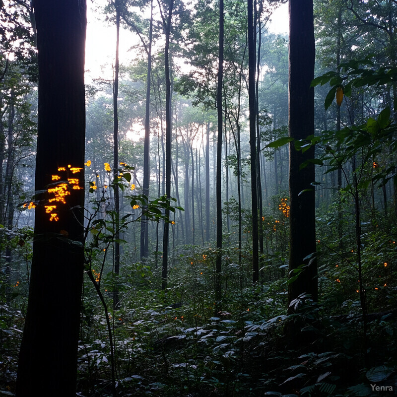
NOAA Coral Reef Watch remains one of the clearest operational examples of environmental early warning, translating near-real-time ocean conditions into bleaching-risk products that can inform reef management. A 2024 paper in Drones showed how UAV imagery and AI could identify drought stress before severe visible decline. Inference: restoration teams can use the same pattern across forests, wetlands, and coasts by treating AI as a way to surface weak signals early enough for field crews to respond.
14. Behavioral Insights from Bioacoustics
The soundscape of a recovering ecosystem is often measurable before the site looks fully mature. AI-driven bioacoustics lets restoration teams use bird calls, frog choruses, fish sounds, and whole-soundscape metrics as practical signals of biodiversity return and behavioral recovery.

A 2023 Nature Communications paper used soundscapes and deep learning to track biodiversity recovery in tropical forest restoration, showing that acoustic evidence can capture ecological change across successional time. A 2024 Scientific Reports study showed that soundscape analysis can also assess early seagrass restoration success. Inference: bioacoustics is one of the most practical ways to detect faunal return before long-interval visual surveys or vegetation structure alone would tell the same story.
15. Precision Pest and Disease Management
Pest and disease management gets stronger when AI narrows the likely problem zones before crews arrive. Predictive models and machine vision can help teams inspect sooner, treat more selectively, and reduce unnecessary disturbance to recovering habitats.

On April 3, 2025, Australia's Department of Agriculture, Fisheries and Forestry described AI work using 37 years of historical data to improve locust-plague forecasting. On March 20, 2025, DHS highlighted new plant-disease detection workflows designed to catch risky biological threats moving through ports of entry. Inference: for restoration, the same pattern is most valuable when it narrows where field teams should inspect or apply targeted controls instead of defaulting to blanket treatment.
16. Automated Restoration Equipment
Automation is expanding from monitoring into direct field intervention, but the most credible deployments are still assistive rather than fully autonomous. AI helps robots navigate, map, and place seeds or propagules more consistently in repetitive, risky, or underwater tasks where human scale is limited.
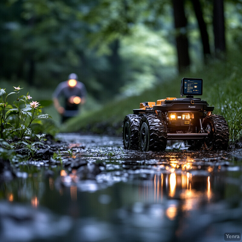
On February 9, 2026, the Great Barrier Reef Foundation described the first field trial of an underwater robot designed to map seafloor conditions and plant seagrass seeds with precision. The 2024 US Forest Service chapter on advances in forest restoration management points to the same broader shift on land: automation is becoming part of restoration operations, but site preparation, species choice, and monitoring still dominate outcomes. Inference: robotics is strongest where the work is repetitive, physically difficult, or highly location-sensitive and where non-target damage has to stay low.
17. Multi-Criteria Decision Support Systems
Restoration planning has to balance hydrology, biodiversity, access, cost, community values, and climate risk at the same time. That is why AI often shows up here as a decision-support system rather than as a stand-alone model.
A 2025 NOAA white paper synthesizes habitat quantification tools used at NOAA Fisheries for kelp and seagrass conservation, restoration, and management, showing how structured decision support is already part of operational habitat work. Michigan EGLE reported on May 22, 2025 that its coastal wetland decision-support tool provides ecological and socioeconomic data to help planners decide where and how to deliver conservation effectively. Inference: the strongest systems do not pretend to produce a single correct answer; they make scenarios, constraints, and tradeoffs visible enough for people to choose well.
18. Nutrient Cycle Optimization
Biogeochemical recovery matters as much as visible vegetation recovery. AI can help identify where nutrient bottlenecks are slowing restoration, but this is strongest when models are tied to repeated soil and water measurements rather than assumptions that planting alone will repair belowground function.
A February 19, 2026 Scientific Reports paper presented hybrid spatiotemporal modeling of nutrient cycling in wetland ecosystems using advanced mapping and machine learning. A December 10, 2025 Scientific Reports paper tracked mangrove restoration using a biogeochemical soil-health index and ecosystem-service indicators. Inference: nutrient-cycle optimization becomes credible when managers can see belowground recovery trends directly, not just infer them from greener vegetation above ground.
19. Learning from Past Interventions
AI only gets truly useful when restoration teams can learn across projects instead of starting from scratch each time. Standardized monitoring, searchable outcomes, and comparable baselines are what let models learn which strategies are working, for whom, and under which conditions.

SER's December 17, 2025 science, practice, and policy highlights show how strongly the field is leaning into standards-based restoration and a third revision of its international principles and standards. A 2025 IUCN technical note on monitoring ecosystem restoration pushes in the same direction by emphasizing harmonized, participatory monitoring across landscapes, wetlands, and seascapes. Inference: AI will learn the most from restoration when project records are structured, comparable, and monitored long enough to capture outcomes rather than just activities.
20. Engaging Local Communities with Predictive Apps
Public support for restoration rises when projected benefits are visible, local, and understandable. AI-assisted maps, digital twins, and visual simulation can help communities see flood buffering, biodiversity return, shade, or water-quality improvement before heavy work begins.

A Frontiers in Climate paper published May 15, 2025 argued that photorealistic 3D visualization can help convey ecosystem-restoration benefits to the public, especially where support depends on seeing plausible future landscapes rather than abstract plans. Restore4Life is building the same idea into practice through a wetland restoration support system and citizen-science workflows. Inference: the strongest community tools are two-way systems that also gather local observations and preferences, not just one-way outreach graphics.
Sources and 2026 References
- Science of the Total Environment: Convolutional neural network for high-resolution wetland mapping with open data
- Pew Charitable Trusts: Innovative Mapping Tool Reveals Hidden Wetlands and Enhances Conservation Efforts
- Nature Machine Intelligence: Fast, scale-adaptive and uncertainty-aware downscaling of Earth system model fields with generative machine learning
- npj Climate and Atmospheric Science: Global spatio-temporal ERA5 precipitation downscaling to km and sub-hourly scale using generative AI
- USDA Climate Hubs: Seedlot Selection Tool
- US Forest Service: Seed Zone WebMap
- Australian Forestry: UAV-assisted seeding and monitoring of reforestation sites: a review
- US Forest Service: Advances in forest restoration management
- Communications Biology: VespAI: a deep learning-based system for the detection of invasive hornets
- Purdue University: Purdue researchers find new ways to track invasive species
- NRCS: Soil Carbon Monitoring and Research Network
- NRCS: Soil Climate Analysis Network
- Wildlife Insights: About Wildlife Insights AI
- NOAA Fisheries: Geospatial Artificial Intelligence For Animals
- Washington Department of Fish and Wildlife: Washington's Habitat Connectivity Action Plan
- Conservation Biology: Trade-offs and efficiencies in optimal budget-constrained multispecies corridor networks
- NOAA: Monitoring and Adaptive Management Manual, 2024 Update
- Ecological Indicators: The critical role of adaptive management in wetland restoration: A 30-year evaluation of the Sun Island wetland, Northeast China
- Nature Geoscience: Limited carbon sequestration potential from global ecosystem restoration
- USGS: Artificial Intelligence for Ecosystem Accounting - ARIES for SEEA
- USGS: Great Lakes Coastal Wetland Ecology, Restoration, and Assessment
- Forest Ecology and Management: Multi-species habitat suitability models to enhance oak species regeneration in the Lower Mississippi Alluvial Valley
- USACE ERDC: Predicting seagrass habitat suitability with remote sensing and machine learning
- NOAA: Coral Reef Watch Homepage and Near Real-Time Products Portal
- Drones: Early Drought Detection in Maize Using UAV Images and YOLOv8+
- Nature Communications: Soundscapes and deep learning enable tracking biodiversity recovery in tropical forest restoration
- Scientific Reports: Soundscape analysis provides an effective means for assessing seagrass restoration success at an early stage
- Australian Department of Agriculture, Fisheries and Forestry: AI to help scientists forecast devastating locust plagues
- DHS Science and Technology: Plant Disease Detection at the Speed of Commerce
- Great Barrier Reef Foundation: The robot that could lead a new era in seagrass restoration on the Great Barrier Reef
- NOAA: Scientific input on natural resource decision-making tools used at NOAA Fisheries for kelp and seagrass habitat conservation, restoration, and management
- Michigan EGLE: Drafting a regional blueprint for coastal wetlands
- Scientific Reports: Hybrid spatiotemporal modeling of nutrient cycling in wetland ecosystems using advanced mapping techniques and machine learning approaches
- Scientific Reports: Tracking mangrove restoration using a biogeochemical soil health index and ecosystem service indicators
- Society for Ecological Restoration: 2025 Science, Practice, and Policy Highlights
- IUCN: Opportunities and Challenges for Monitoring Ecosystem Restoration
- Frontiers in Climate: Using photorealistic 3D visualization to convey ecosystem restoration to the public
- Restore4Life: Empowering Communities: The Role of Citizen Scientists in Wetland Restoration
Related Yenra Articles
- Environmental Monitoring shows the sensing and change-detection layer behind restoration follow-through.
- Ecological Niche Modeling adds habitat-suitability logic for choosing where restoration is most likely to hold.
- Bioacoustics Research Tools extends the sound-based monitoring thread used to track faunal return.
- Animal Tracking and Conservation connects restored landscapes to the species meant to move through and use them.
- Climate Adaptation Strategies connects restoration planning to longer-horizon resilience decisions.
- Geospatial Analysis adds the mapping and spatial-prioritization layer behind site selection and corridor planning.