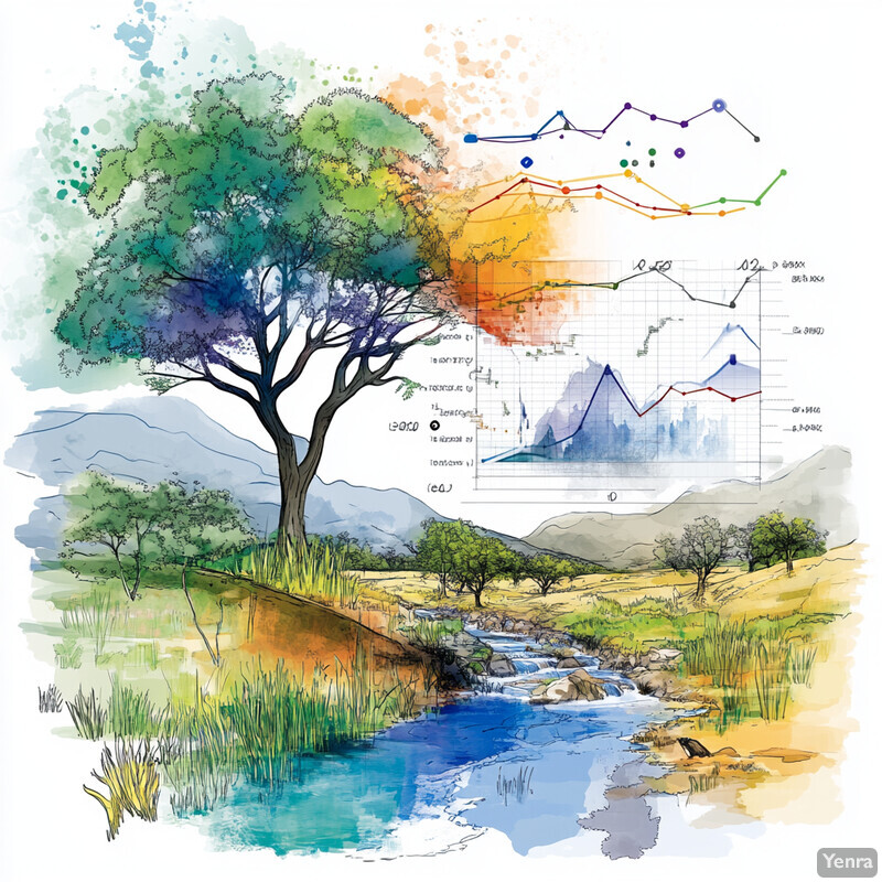
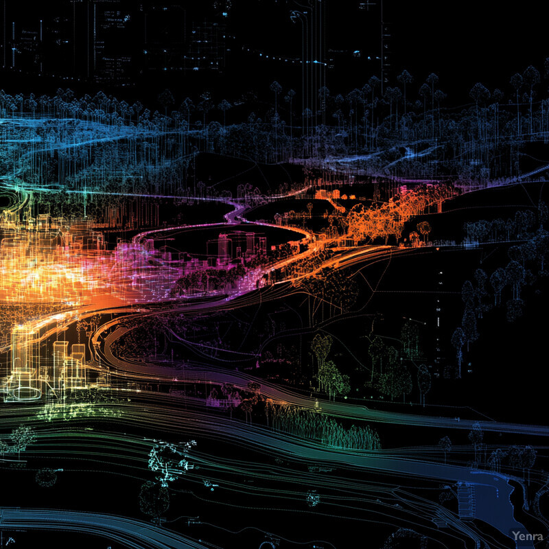
Environmental impact assessments get stronger when AI is used as an evidence and modeling layer across the full review cycle rather than as a generic add-on. In 2026, the most credible gains come from better remote sensing, faster change detection, stronger wildlife detection, more local climate-risk screening, explainable water and air modeling, and better ways to combine maps, monitoring feeds, and environmental documents inside a GIS-centric workflow.
That matters because modern EIAs fail less often on theory than on integration. Baselines get stale. Cumulative effects are treated narratively instead of spatially. Water and air sections remain too slow to test many alternatives. Community burden analysis is disconnected from physical exposure maps. And monitoring data often arrives too late to improve the original assessment. AI is strongest here when it compresses the lag between observation, interpretation, scenario testing, and mitigation design.
This update reflects the category as of March 19, 2026. It focuses on the parts of the field that feel most real now: long-horizon geospatial baselining, iterative ecological forecasting, automated species detection, sensor-driven monitoring, climate hazard screening, explainable hydro models, plume and spill detection, Document AI for environmental records, surrogate models for scenario testing, and monitoring-to-model feedback loops supported by data assimilation and digital twins.
1. Enhanced Remote Sensing Analysis
Remote sensing is most useful to EIAs when AI turns imagery archives into repeatable baseline maps and disturbance records rather than one-off picture interpretation. The practical value comes from temporal depth, consistent classification, and the ability to refresh land-cover evidence quickly as projects evolve.

A March 2026 Environmental Modelling & Software study used deep neural networks and Google Earth Engine to generate annual land-use and land-cover maps from 1985 to 2025 in a semi-arid region, reaching 96.65% and 97.60% accuracy across Landsat eras. A separate 2025 CNN-based land-cover classification study for change-detection work reported 93.5% accuracy, versus 84.8% for random forest and 72.9% for SVM. Inference: AI remote sensing is now strong enough to support long-horizon baseline construction and repeatable disturbance tracking instead of isolated map snapshots.
2. Predictive Modeling of Ecosystem Impacts
Ecosystem-impact modeling gets stronger when forecasts are updated on management timescales instead of being locked into a single pre-construction report. AI is especially valuable when it can move ecological forecasting from retrospective description toward near-term anticipation.
A 2024 Nature Climate Change perspective argued that ecological forecasting must move onto actionable daily-to-decadal timeframes rather than relying mainly on long-term projections. Nature Ecology & Evolution then showed a 2025 biodiversity digital twin built around 580 permanent point-count locations, with peak days exceeding 1,000 hours of recordings and more than 100,000 detections. Inference: ecosystem-impact modeling is shifting from static baseline chapters toward iterative forecasting systems that can absorb new observations during the life of a project.
3. Automated Species Identification
Automated species identification is strongest when AI is used to triage enormous image, audio, and satellite datasets while humans stay focused on threshold-setting and review of consequential detections. The benefit is scale, not the removal of expert judgment.

The 2025 Njobvu-AI camera-trap platform reported average precision, recall, and F1 scores above 0.70 for all classes with more than 1,000 training images and for some species with as few as 49 or 101 images. NOAA's 2025 GAIA program is now tasking very high-resolution satellite imagery over North Atlantic right whale habitat and using AI-flagged interesting points to support side-by-side comparison with 2021-2024 aerial surveys. Inference: species detection has become operationally useful for EIA screening, but threshold choice and validation still matter most for rare or legally sensitive species.
4. Real-Time Environmental Monitoring
Real-time monitoring is valuable when AI turns continuous measurements into current-state awareness that can affect management, not when it merely creates more dashboards. The key step is moving from sensor collection to early interpretation.

USGS reports that its AI work already includes toxic-algae identification, pollutant mapping, risk forecasting, and PFAS prediction in groundwater and soils across the United States. In Portland, a USGS water-quality monitor redeployed for the 2025 season is collecting near-real-time temperature, pH, dissolved oxygen, specific conductance, chlorophyll, and phycocyanin during the period when harmful blooms are most likely. Inference: post-approval EIA monitoring is becoming more like a live operational system, with AI increasingly used to prioritize where attention should go next.
5. Enhanced Climate Risk Assessment
Climate-risk sections get stronger when they combine local hazard screening, multidecadal scenarios, and faster AI forecasts rather than relying only on broad static climate narratives. The operational question is what hazards change at the project scale and on what timeline.

CEQ points agencies to the Climate Mapping for Resilience and Adaptation portal, which screens extreme heat, drought, wildfire, inland flooding, and coastal flooding at census-tract scale and provides early-, mid-, and late-century projections. In parallel, Nature's 2025 Aurora paper introduced a foundation model trained on more than one million hours of geophysical data that outperforms operational systems for air quality, ocean waves, tropical cyclone tracks, and high-resolution weather at orders of magnitude lower computational cost. Inference: climate-risk assessment inside EIAs can now be more local, multi-hazard, and iterative than the coarse scenario appendices common a few years ago.
6. Cumulative Impact Analysis
Cumulative impact analysis becomes more credible when environmental burdens and community vulnerability are mapped together rather than treated as separate chapters. AI helps most by ranking overlapping pressures spatially and consistently.
CEQ's current NEPA guidance says agencies should assess whether proposed effects result in or add to disproportionate and adverse effects on communities with environmental justice concerns, explicitly taking cumulative impacts into account. EPA's EJScreen 2.3 contains 13 environmental burden indicators and combines them with demographic and supplemental demographic indexes. Inference: AI-assisted cumulative-impact analysis is increasingly a burden-combination and hotspot-ranking workflow rather than a brief narrative note that impacts may accumulate.
7. Adaptive Habitat Modeling
Habitat modeling is strongest when models communicate both expected shifts and the uncertainty around them. In fast-changing landscapes, the question is not only where habitat is likely to move, but where prediction confidence degrades.

A 2025 Scientific Reports study found that 11.4% of global land surface has a high vulnerability, meaning more than 90% probability of changing to a different biome-climate envelope under the conservative RCP 4.5 scenario by 2080. The same study found that an equally large region becomes highly uncertain, with multiple possible future biome states, and noted that novel climate combinations raise model uncertainty further. Inference: adaptive habitat sections in EIAs should show both projected redistribution and where the limits of extrapolation start to matter.
8. Improved Groundwater and Surface Water Modeling
Water modeling improves when AI reduces run times enough to support uncertainty analysis and also makes the drivers of predicted degradation easier to interpret. Fast answers are only useful when teams know what shaped them.

A 2024 Advances in Water Resources paper showed that a U-Net surrogate for transient groundwater inverse problems reduced computational time by about an order of magnitude while still supporting rapid uncertainty quantification. A 2025 Scientific Reports groundwater quality study paired machine learning with SHAP analysis so practitioners could identify which physicochemical parameters and trace elements were driving predicted contamination levels. Inference: groundwater and surface-water assessment is moving from slow and opaque modeling toward faster, more explainable hydrogeologic analysis.
9. Early Detection of Pollution Events
Early-warning systems matter because many environmental incidents are costly precisely because they are noticed too late. AI helps most when it turns weak signals into faster escalation before impacts spread.

A 2024 Journal of Hazardous Materials study notes that Daphnia-based biological early-warning systems have successfully detected sudden contaminant spills in surface waters and can trigger alarms from behavioral changes. NASA then reported in October 2024 that the Tanager-1 imaging spectrometer detected a methane plume from a landfill in Karachi extending about 4 kilometers, with a preliminary estimate above 1,200 kilograms of methane per hour. Inference: early pollution detection is expanding into a multi-scale workflow that can combine biosensors, field telemetry, and orbital plume detection.
10. Streamlined Data Integration
The hidden bottleneck in many EIAs is still evidence assembly. AI is most helpful when it reduces the friction of combining gridded models, field observations, remote sensing, and document-based evidence into one reviewable analytical workflow.

Aurora was trained on more than one million hours of diverse geophysical data and fine-tuned across multiple Earth-system tasks, showing how a single AI stack can be adapted across forecasting domains. At the document layer, a 2025 ACS Environmental Science & Technology paper described a three-stage LLM framework that classifies relevant literature, pretrains on selected texts, and extracts life cycle inventory and environmental impact data. Inference: EIA data integration is starting to move from manual appendix compilation toward machine-assisted retrieval, harmonization, and evidence tracing.
11. Optimized Site Selection
Alternative-site analysis is strongest when AI helps narrow the search transparently across environmental, physical, and community constraints. The best systems support defensible screening, not false certainty.

A 2024 Environmental Technology & Innovation paper combined GIS, fuzzy AHP, clustering, and explainable AI for landfill siting, classifying 20.60% of the study area as highly suitable and reporting R2 of 0.882 for the XAI zoning model. USGS also reports that AI is being used to predict regions with resource abundance and minimal negative impact, supporting sustainable resource management and expediting permitting routines. Inference: AI-based site selection is most useful when it helps compare and explain alternatives early, before teams commit to a weak corridor or footprint.
12. Enhanced Scenario Testing
Scenario testing gets much stronger when surrogate models make more alternatives computationally affordable. AI matters here because many environmental models are too slow to compare enough plausible futures under normal review timelines.

A 2025 Environmental Modelling & Software paper developed random-forest surrogates for maximum flood depth and velocity and emphasized their computational efficiency for real-time flood simulation. A 2024 Scientific Reports groundwater study then generated sixteen future scenarios by combining machine learning with multiple climate pathways and planning years from 2025 through 2040, with the ANN model achieving AUC of 0.875. Inference: scenario testing inside EIAs is becoming broader and faster because AI surrogates let teams explore more design and climate combinations without rerunning every full-physics model from scratch.
13. NLP for Document Analysis
Natural-language processing becomes useful to environmental review when it extracts structure from large text collections without breaking auditability. The real benefit is faster scoping, records review, and synthesis of recurring issues across many files.

A 2025 Science of the Total Environment case study analyzed 2,539 interview paragraphs from 20 wastewater inspectors and planners, identified three distinct themes with a silhouette score of 0.6136, and reached 94.53% accuracy with XGBoost in classifying new text into those themes. In parallel, the 2025 ACS framework for literature mining targeted automated retrieval of life cycle inventory and environmental impact data. Inference: document AI is moving beyond generic summarization into practical extraction of themes, burdens, and decision-relevant evidence for environmental review.
14. Biodiversity Forecasting Under Climate Change
Biodiversity forecasting improves when models move onto near-term decision windows and can be recalibrated as new observations arrive. That is what makes AI more useful for EIAs than long-range species maps alone.

Nature Climate Change argues that ecological forecasting for climate action needs to emphasize iterative daily-to-decadal predictions. Nature Ecology & Evolution's 2025 biodiversity digital twin shows what that looks like in practice: more than 100,000 detections, 263 detectable species, and 110 species observed with 90% confidence more than 5,000 times, with raw audio retained for reclassification as models improve. Inference: biodiversity forecasting is becoming a continuously updated monitoring-and-prediction loop rather than a one-time climate appendix.
15. Social-Environmental Data Fusion
The strongest EIAs combine exposure, demographics, and local knowledge instead of treating social impacts as a separate downstream exercise. AI helps by making fused screening layers faster to build and easier to compare across alternatives.

EPA's 2024 EJScreen documentation states that version 2.3 includes 13 EJ Indexes and 13 Supplemental Indexes built by combining environmental burden indicators with demographic measures. CEQ guidance says agencies may use screening tools, public input, social science research, Indigenous Knowledge, and other high-quality information together to identify communities with environmental justice concerns. Inference: social-environmental fusion works best as a prioritization layer for outreach, alternatives, and mitigation design, not as a substitute for engagement.
16. Improved Accuracy in Air Quality Predictions
Air-quality assessment gets stronger when AI weather and chemistry surrogates improve forecast skill for difficult transport events. This matters because episodic peaks often drive the real-world risk and public response.

Nature's Aurora model outperforms operational systems in air-quality forecasting while running at far lower computational cost. In 2026, npj Clean Air reported that AI-DUST improved 48-hour forecast threat scores by 27% relative to a traditional operational model across fourteen East Asian dust events in spring 2025, and maintained useful 10-day skill with TS above 0.22. Inference: AI air-quality tools can materially strengthen EIA exposure analysis, especially where wildfire smoke, dust, or other episodic transport events shape local risk.
17. Acoustic and Bioacoustic Monitoring
Acoustic monitoring is increasingly practical for EIAs because AI can process continuous audio streams at a scale that would overwhelm manual review. The result is better temporal coverage for biodiversity and disturbance monitoring.

The 2025 biodiversity digital twin in Nature Ecology & Evolution implemented 580 permanent point-count locations, with peak days exceeding 1,000 hours of recordings and more than 100,000 detections. The app can detect 263 bird species, and 110 species have already been observed more than 5,000 times at 90% confidence. Inference: bioacoustic monitoring has matured into a realistic baseline, construction, and adaptive-management layer for EIAs when paired with validation and threshold control.
18. Reduced Fieldwork Costs and Times
AI does not eliminate fieldwork, but it changes fieldwork from blanket coverage toward targeted verification. That shift saves time by letting teams concentrate physical effort where uncertainty or ecological sensitivity is highest.
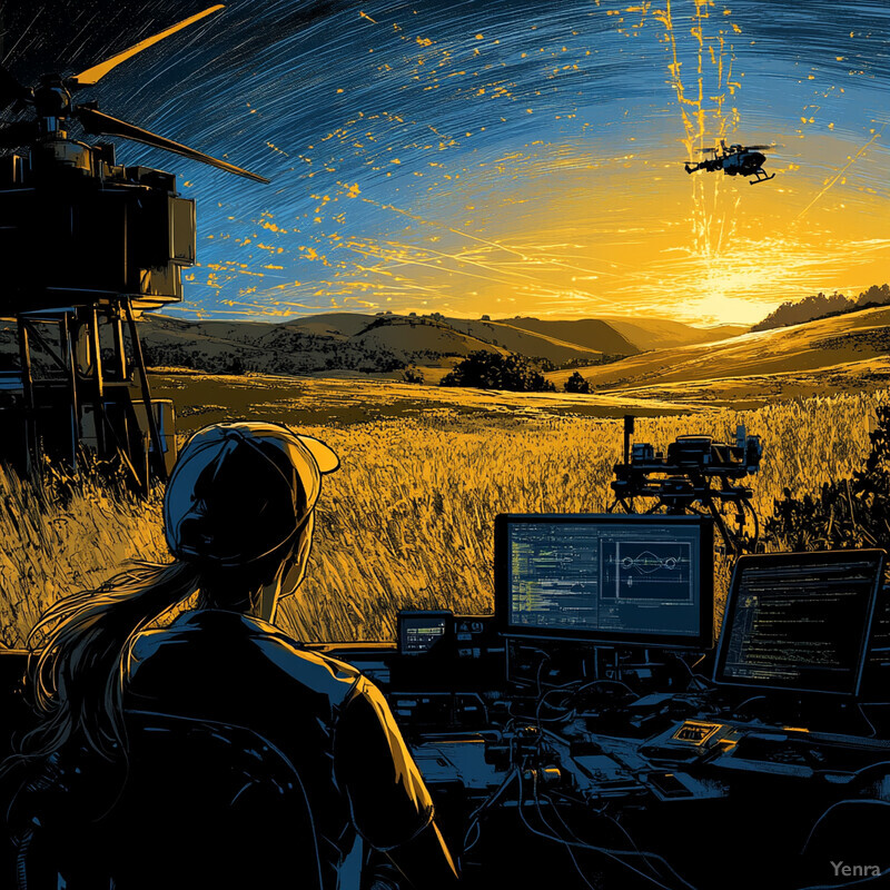
NOAA's GAIA program uses tasked very high-resolution satellite imagery and semi-automated AI review to focus attention on candidate whale detections in critical habitats instead of depending only on repeated broad-area flights. Njobvu-AI also showed that model-predicted species richness tracked confirmed detections reasonably well and that performance can be strong enough for local workflows when classes are sufficiently represented. Inference: AI reduces review load best by pushing experts toward confirmation, threshold tuning, and targeted follow-up instead of exhaustive first-pass scanning.
19. Transparent Decision Support Tools
AI only helps trust in environmental review when its outputs are inspectable through maps, buffers, alternative comparisons, and linked documents. Transparent decision support is about making assumptions easier to examine, not hiding them behind automation.

EPA's NEPA site says its searchable EIS Database includes information on all EISs filed since 1987, EPA comment letters since 2001, and PDF files for most EISs filed since October 2012. CEQ guidance also says agencies should explain why they selected the screening tool used in an analysis and may organize environmental-justice analysis within resource-specific sections such as air, water, or land. Inference: AI decision support is strongest when it is built around inspectable source material and geography that reviewers can challenge, compare, and understand.
20. Continuous Improvement Through Feedback Loops
The strongest EIA practice in 2026 is adaptive. AI makes environmental review more useful when monitoring feeds back into forecasts, mitigation rules, and operating decisions instead of sitting in a compliance archive.

The 2025 biodiversity digital twin stores raw audio so detections can be reclassified as models improve, while the observation board updates continuously as new signals arrive. Nature Climate Change frames this as near-term iterative ecological forecasting, and CEQ guidance notes that where relevant agencies must include mitigation measures in compliance and monitoring plans. Inference: AI makes living environmental reviews more practical by shortening the loop from observation to model update to management response.
Related AI Glossary
- Remote Sensing covers the satellite, aerial, and drone evidence base behind baseline mapping and disturbance detection.
- Change Detection explains how repeated imagery and time-series comparisons become operational evidence of environmental change.
- Geographic Information System (GIS) grounds the spatial workspace where alternatives, burdens, and mitigation measures are compared.
- Data Assimilation explains how monitoring feeds can be folded back into ongoing models and forecasts.
- Surrogate Model is the key idea behind faster what-if testing when full environmental simulations are too slow.
- Document AI connects directly to extracting evidence from permit files, comments, studies, and legacy reports.
- Source Apportionment matters when EIAs need to separate local emissions from regional or episodic pollution sources.
- Time Series Forecasting helps explain iterative ecological, hydrologic, and air-quality prediction.
- Bioacoustics adds always-on biodiversity monitoring through sound rather than only through visual surveys.
- Passive Acoustic Monitoring extends that idea into recorder networks that support baseline and compliance monitoring over time.
Sources and 2026 References
- Environmental Modelling & Software: Mapping Four Decades of Change: Deep Learning and Google Earth Engine for Annual LULC Classification in Semi-Arid Regions.
- Results in Engineering: Land use and land cover classification for change detection studies using convolutional neural network.
- Nature Ecology & Evolution: A digital twin for real-time biodiversity forecasting with citizen science data.
- Nature Climate Change: Near-term ecological forecasting for climate change action.
- Ecology and Evolution: Developing custom computer vision models with Njobvu-AI.
- NOAA Fisheries: Satellite Monitoring of North Atlantic Right Whales.
- U.S. Geological Survey: Artificial Intelligence in the USGS Ecosystems Mission Area.
- U.S. Geological Survey: Water-quality monitor at the OMSI dock is live for the 2025 season.
- Scientific Reports: Climate vulnerability of Earth's terrestrial biomes.
- Advances in Water Resources: A U-Net architecture as a surrogate model combined with a geostatistical spectral algorithm for transient groundwater flow inverse problems.
- Scientific Reports: Explainable machine learning framework for assessing groundwater quality and trace element contamination in Eastern Saudi Arabia.
- Journal of Hazardous Materials: Machine learning-based water quality prediction using octennial in-situ Daphnia magna biological early warning system data.
- NASA: First Greenhouse Gas Plumes Detected With NASA-Designed Instrument.
- Environmental Science & Technology: A Large Language Model-based Framework to Retrieve Life Cycle Inventory and Environmental Impact Data from Scientific Literature.
- Environmental Technology & Innovation: A decision-making framework for landfill site selection in Saudi Arabia using explainable artificial intelligence and multi-criteria analysis.
- Environmental Modelling & Software: A surrogate machine learning model using random forests for real-time flood inundation simulations.
- Scientific Reports: Future groundwater potential mapping using machine learning algorithms and climate change scenarios in Bangladesh.
- Science of the Total Environment: Examining the perspectives of environmental inspectors and planners through a developed Natural Language Processing pipeline.
- EPA: EJScreen Technical Documentation for Version 2.3.
- CEQ: National Environmental Policy Act - Fiscal Responsibility Act of 2023 Guidance.
- CEQ: NEPA GHG Tools and Resources.
- Nature: A foundation model for the Earth system.
- npj Clean Air: An artificial intelligence model for sand and dust storm forecast driven by AI weather forecasts.
Related Yenra Articles
- Geospatial Analysis covers the spatial evidence layer that many stronger EIAs now depend on.
- Ecological Niche Modeling goes deeper on habitat and species-distribution forecasting.
- Water Quality Monitoring focuses on one of the most important real-time evidence streams for impact review.
- Greenhouse Gas Emission Modeling extends the emissions and climate accounting side of environmental review.
- Natural Habitat Restoration follows environmental assessment into mitigation, recovery, and ecological repair.