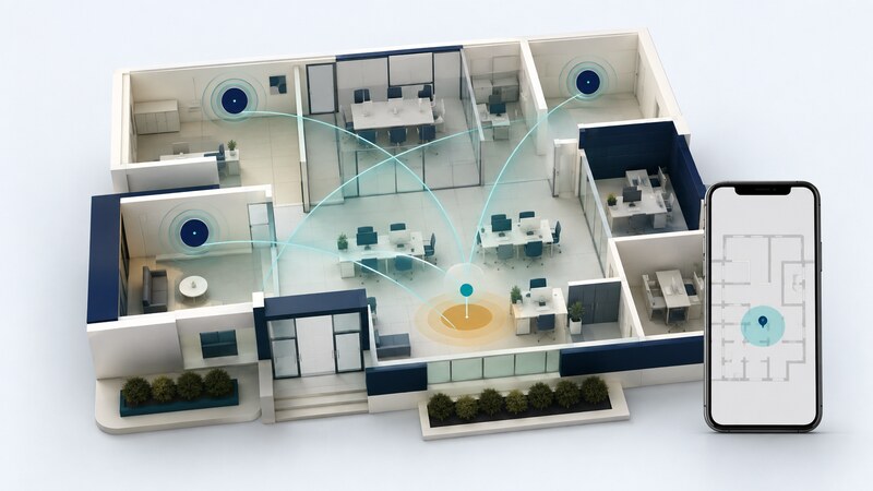
Wi-Fi positioning uses observations of nearby wireless access points to help estimate a device's location. It can complement satellite positioning where signals are obstructed, especially indoors and among buildings.
Here, WPS means Wi-Fi positioning system. It is separate from Wi-Fi Protected Setup, the router feature used to help connect devices. Positioning also differs from geocoding an address and from locating an internet connection by its IP address.
Three methods that use different evidence
| Method | Evidence used | What must be maintained |
|---|---|---|
| Location database lookup | Observed access-point identifiers matched with location records. | Useful coverage and up-to-date access-point locations. |
| Signal fingerprinting | A measured pattern of signal strengths compared with surveyed examples. | A representative radio map and checks after environmental changes. |
| Round-trip-time ranging | Supported devices measure distance-related packet timing. | Compatible hardware, access-point coordinates, and measurement quality. |
A Wi-Fi network name, or SSID, is not a unique geographic address. Many networks share names. Implementations may use access-point identifiers such as BSSIDs along with signal information; distinguish those from a phone's own network address.
These methods can be combined with other sources. A phone's location service may return a fused estimate without exposing a simple “Wi-Fi only” result to every app. GPS on Phones explains why source, freshness, and permissions matter.
Understand what a location service returns
The Google Geolocation API documentation describes a service that accepts cell and Wi-Fi observations and returns a position with an accuracy radius. It also describes filtering unsuitable access-point addresses and controlling IP-based fallback.
Fallback matters during evaluation: a successful response does not prove that Wi-Fi observations produced it. Inspect the service's documented behavior and record the inputs. An estimate based on an IP address can serve a different purpose from an indoor position.
Moved, replaced, or unrecorded access points can reduce the usefulness of database matching. Several radio identifiers from one physical device do not necessarily supply independent location evidence. Check the provider's requirements rather than counting every visible identifier as a separate landmark.
A radius should be presented with the service's stated meaning. Do not silently reinterpret it as a guaranteed boundary or assign it a confidence percentage that the provider has not specified.
RTT measures distances; software estimates position
Wi-Fi round-trip time (RTT) uses supported timing exchanges to estimate distance to compatible access points. The Android Wi-Fi RTT guide explains hardware support, access-point location information, permissions, and version-dependent behavior. Installing an app does not give an unsupported radio RTT capability.
With distances to multiple access points at known coordinates, software can estimate a position that fits the measurements. Access-point geometry, reflections, device orientation, and height differences affect the result. Wi-Fi RTT does not require ordinary association with the access point, but compatible ranging support is still needed.
Evaluate a building, not just a demonstration
Define the needed result: building identification, floor selection, room-level assistance, or a continuous path. Those are different evaluation tasks. A system can identify the building reliably while confusing adjacent rooms or floors.
- Establish check locations independently and record their coordinate system.
- Collect repeated measurements with representative devices, orientations, and occupancy.
- Test corridors, stairs, room boundaries, and areas with poor access-point geometry.
- Measure failed estimates, time to a result, floor errors, and horizontal errors.
- Repeat after access points move or the building layout changes.
Report how often the system produces a result alongside its error statistics. A small median error among successful estimates can hide frequent failures. Keep stationary tests separate from moving-path tests, where latency also matters.
For fingerprinting, evaluate on observations collected separately from the training survey. Randomly splitting nearly identical scans can make performance look better than it will be on another day or device.
Keep permissions, data handling, and uncertainty visible
Use the platform's supported APIs and permission model, and check the requirements for the target operating-system version. Explain why the app uses location and which observations leave the device. Access-point records and movement histories deserve deliberate retention and access choices.
A useful display shows estimate age and uncertainty and has an explicit unavailable state. Avoid snapping every point to the nearest room when the evidence does not distinguish rooms. Map matching is an inference that should remain distinguishable from the source observations.
AI can help prototype a fingerprint classifier, review synthetic ranging data, or write evaluation scripts. Supply independent check locations and require separate reporting for training and later tests. A generated floor plan or a plausible reconstructed path is not ground truth.