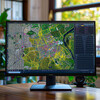
Enhanced Accuracy of GIS Data 3 - Image Index | 10 Ways AI is Improving Geospatial Analysis Data Analysis in Progress: A man intently examining a large screen displaying various data and graphics. He is wearing a dark jacket and has short brown hair, with his attention focused on the screen as he points to it with his right hand. The screen itself appears to be a large monitor or television, showcasing an array of graphs, charts, and other visual representations of data. In the background, there are several other screens visible, although they are not as prominent as the one in the foreground. Overall, the image suggests that the man is engaged in some kind of data analysis or research, possibly related to a project or presentation.