The Global Positioning System (GPS) is the U.S.-owned satellite navigation system that provides positioning, navigation, and timing services. In everyday language, people often say "GPS" for any satellite-based location feature, but many modern devices also use other global navigation satellite systems, cellular signals, Wi-Fi positioning, inertial sensors, maps, and correction services. The best location products are rarely just a chip listening to satellites; they are full systems that turn position and time into useful decisions.
That is why GPS feels ordinary and powerful at the same time. It guides a driver, timestamps a network, marks a drone waypoint, maps a run, steers a tractor, routes a truck, helps dispatchers find a caller, and lets aircraft fly more direct routes. Its value comes from connecting location to action.
1. Smartphones
Smartphones turned GPS from a specialized receiver feature into a daily interface for maps, ride sharing, local search, delivery, photos, safety alerts, weather, fitness, payments, and location sharing.
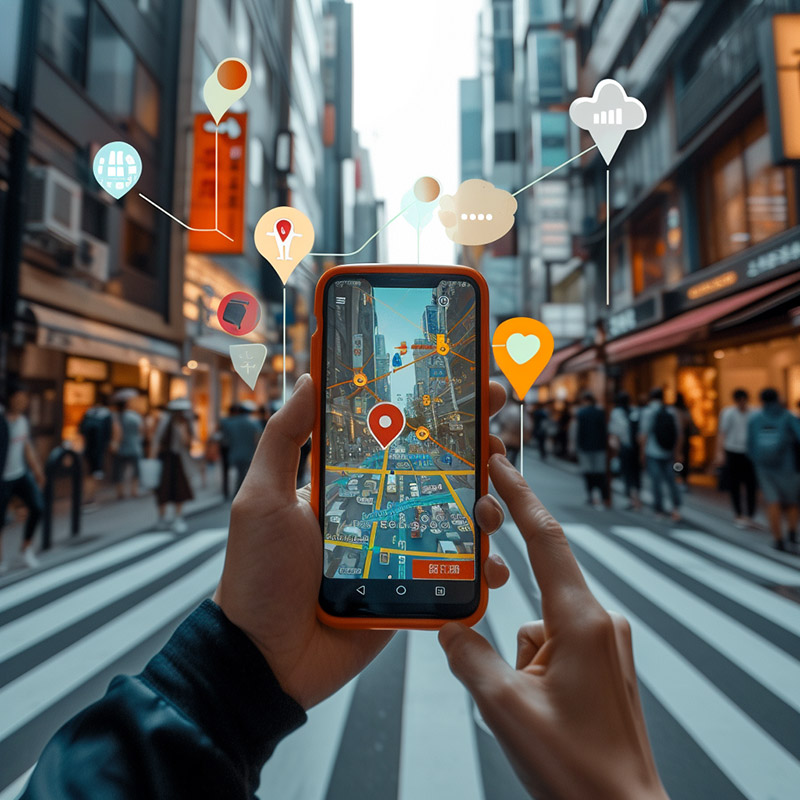
Before GPS became common in phones, mobile location was approximate and many tasks required paper maps, printed directions, landmarks, or manual address entry. Even when a person knew where they were, sharing that location precisely with an app, business, driver, or emergency contact was difficult.
Modern phones combine satellite positioning with network and sensor data so location can work faster and more reliably in cities, vehicles, and indoor-adjacent environments. The user sees a blue dot, but behind it is a system that blends signals, permissions, maps, and application logic.
NIST explains that mobile GPS receivers compare satellite time signals with the device clock to determine location, while GPS.gov describes GPS as a positioning, navigation, and timing service for civilian and military users. Inference: smartphones made GPS valuable by pairing satellite positioning with software ecosystems that can act on that location immediately.
2. Automotive Navigation Systems
Vehicle navigation uses GPS to place the car on a map, but the finished experience also depends on map matching, traffic data, routing algorithms, lane guidance, vehicle sensors, and driver-interface design.
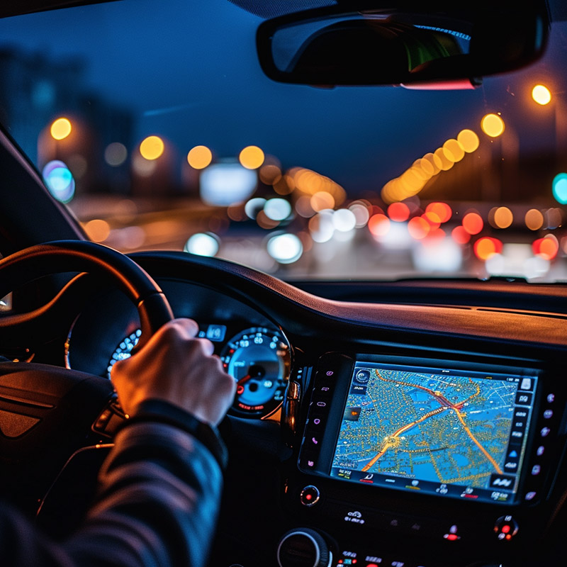
Before GPS navigation, drivers used road atlases, printed route sheets, verbal directions, and highway signs. Missed turns were harder to recover from, traffic changes were discovered too late, and trips through unfamiliar cities demanded much more attention.
GPS-enabled navigation systems provide turn-by-turn guidance, estimated arrival times, rerouting, traffic-aware route changes, and location-aware assistance. In connected cars, the same position stream can support roadside assistance, usage-based services, stolen-vehicle recovery, and driver-support features.
GPS.gov notes that GPS improves efficiency and safety for vehicles using highways, streets, mass transit, road maintenance, and emergency vehicle operations. Inference: automotive GPS is not only a convenience feature; it is a transportation-management layer that helps roads, fleets, drivers, and services coordinate around location.
3. Wearable Fitness Trackers
Wearables use GPS to turn outdoor movement into measurable routes, splits, pace, elevation, recovery trends, and safety signals. For runners, cyclists, hikers, and walkers, location becomes a training record.
Before GPS wearables, athletes estimated distance from known routes, bicycle computers, stopwatches, trail signs, or later desktop map tools. Those methods worked, but they made pace, route comparison, and performance history less precise.
GPS fitness devices can record the actual path taken and connect it to heart rate, cadence, speed, grade, temperature, and training load. Better devices also preserve battery life by blending satellite fixes with inertial sensors and smart sampling.
NOAA's National Geodetic Survey explains that a receiver, including one in a phone or car, listens for satellite signals that can determine location on the ground within seconds. Inference: fitness trackers apply that same receiver principle to repeated personal measurements, where consistency across workouts can be as important as a single absolute position.
4. Smartwatches
Smartwatches make GPS wrist-level. That matters for navigation, exercise, emergency features, family location, outdoor routes, device finding, and moments when carrying a phone is awkward.
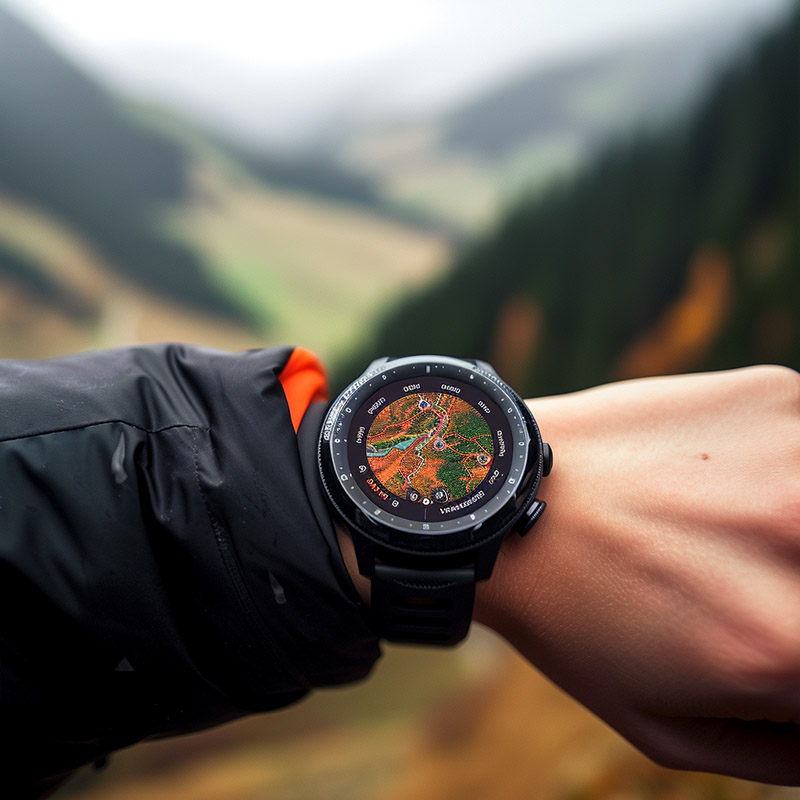
Before GPS smartwatches, wrist devices could measure time, steps, or basic motion, but they could not independently map a route or guide a user through unfamiliar terrain. Outdoor navigation usually required a phone, handheld GPS unit, or paper map.
Modern GPS smartwatches support route tracking, breadcrumb navigation, workout maps, fall or crash context, find-my-device features, and location-aware reminders. The best designs make location useful without forcing the user to stare at a larger screen.
GPS accuracy depends on receiver quality, satellite geometry, environment, signal availability, and augmentation. Inference: watch-sized GPS is impressive because it compresses a difficult radio and power-management problem into a small device that still has to be readable, durable, and socially wearable.
5. Drones
GPS lets drones hold position, follow waypoints, return home, geotag imagery, map fields and sites, support search operations, and operate with more repeatability than manual flight alone.
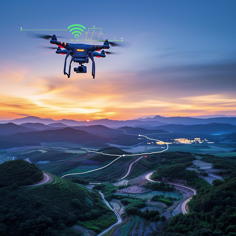
Before GPS-assisted drones, small unmanned aircraft were harder to stabilize, harder to recover after signal loss, and less useful for repeatable mapping routes. Pilots had to manage position visually and manually, which limited practical applications.
GPS-enabled drones can automate flight paths, maintain geofences, return to launch, align photo grids, and connect images to precise locations. Professional systems often combine GPS with inertial measurement units, barometers, visual positioning, RTK corrections, and mission-planning software.
The FAA's UAS materials emphasize safe integration of drones into the National Airspace System, including authorization processes for controlled airspace. Inference: drone GPS is useful only when paired with airspace awareness, pilot responsibility, fail-safe behavior, and regulatory compliance.
6. Portable Navigation Devices
Handheld GPS units remain useful because they are built for rough conditions, long trips, offline maps, gloves, water, battery swaps, waypoints, and backcountry decision-making.
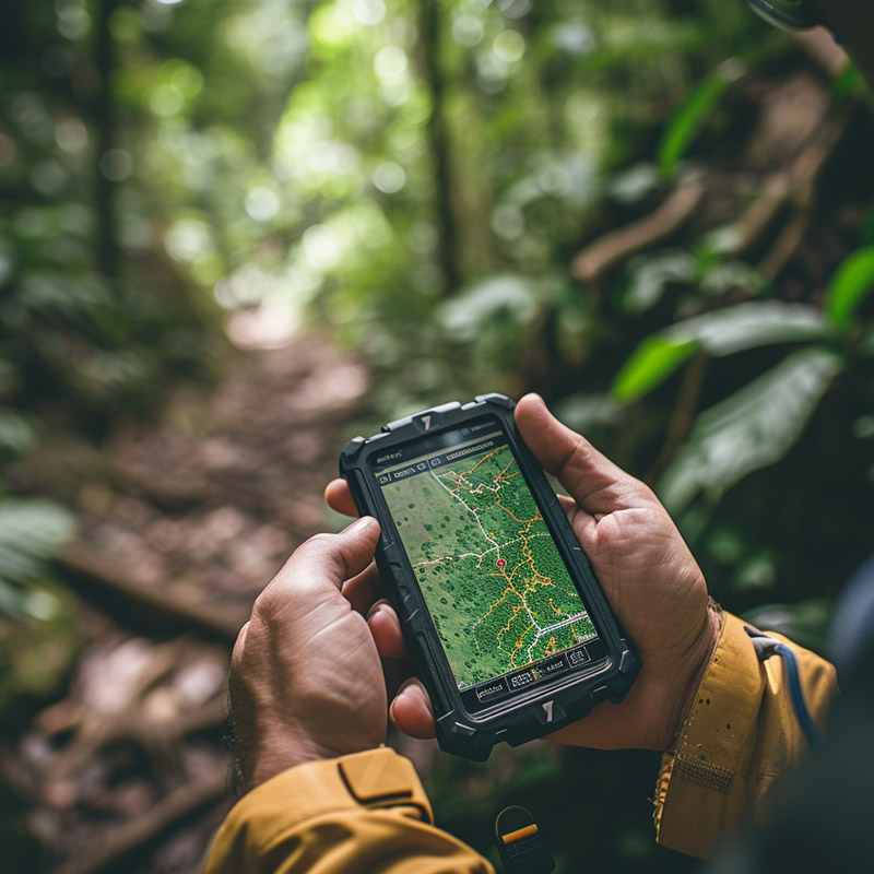
Before portable GPS receivers, hikers, boaters, surveyors, field crews, and search teams depended on paper maps, compasses, landmarks, and dead reckoning. Those skills remain important, but position fixes were slower and more vulnerable to weather, fatigue, darkness, or poor visibility.
Portable GPS devices provide coordinates, waypoints, tracks, routes, elevation, bearings, and saved paths. In remote areas, they are most reliable when used with maps, compass skills, spare power, and an understanding that satellite reception can be degraded by terrain, tree cover, buildings, and weather effects.
USGS describes handheld GPS receivers as accurate tools for determining location on terrain, while NOAA explains the basic receiver principle of measuring satellite signals. Inference: dedicated handhelds still earn their place when ruggedness, offline reliability, and field workflow matter more than app convenience.
7. Fleet Management Systems
Fleet systems use GPS to coordinate vehicles, drivers, routes, maintenance, safety, fuel use, dispatch, proof of service, and customer expectations.
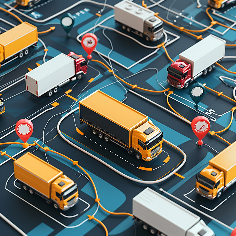
Before GPS fleet tracking, dispatchers relied on scheduled check-ins, radio calls, driver reports, paper logs, and estimated arrival times. That made exceptions harder to catch and made routing, utilization, and customer updates less accurate.
GPS fleet platforms can show vehicle position, route adherence, idle time, stop history, driver behavior, geofence events, maintenance triggers, and delivery progress. The strongest systems combine GPS with telematics from the vehicle and workflow data from dispatch, inventory, and customer systems.
GPS.gov connects GPS to increased efficiencies and safety for vehicles, mass transit, road maintenance crews, and emergency vehicles. Inference: fleet GPS works best when location is not only displayed on a map but used to make dispatch, safety, maintenance, and service decisions faster.
8. Agricultural Equipment
Precision agriculture uses GPS and correction services to guide tractors, plan passes, reduce overlap, vary inputs, map yield, and make field work more repeatable.
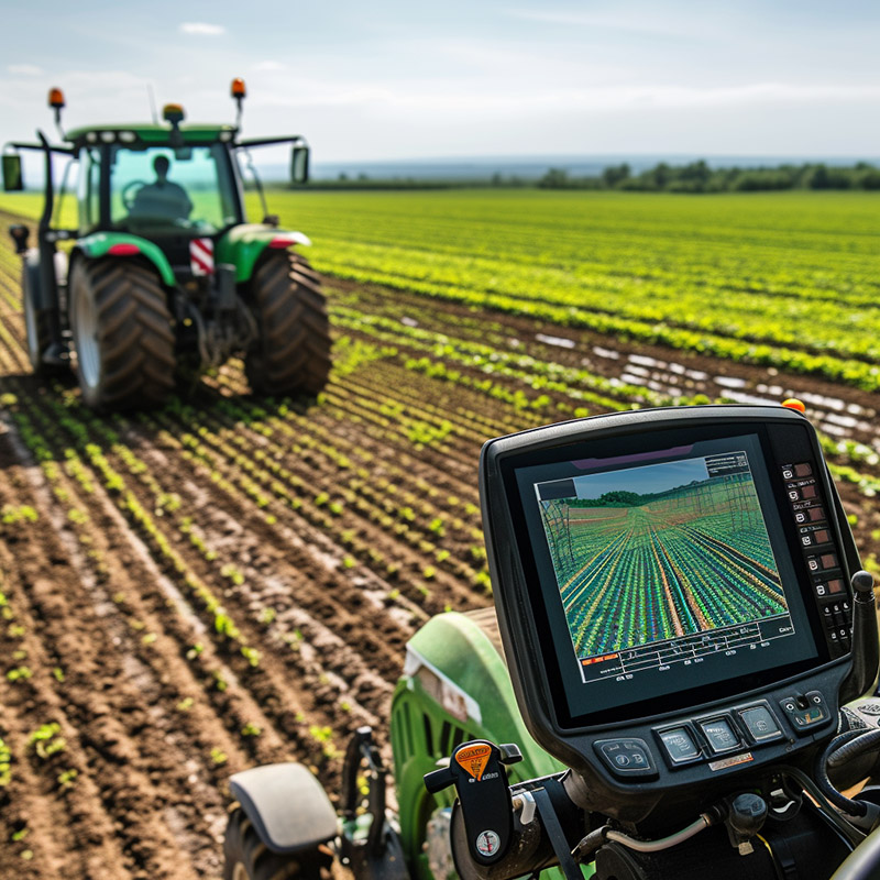
Before GPS-guided equipment, field operations depended heavily on operator judgment, markers, visual references, and repeated passes that could overlap or leave gaps. That wasted seed, fertilizer, fuel, labor, chemicals, and time.
GPS guidance and autosteer can make field passes straighter and more consistent. Combined with soil maps, yield monitors, variable-rate controllers, and farm-management systems, location becomes the organizing layer for applying the right action in the right part of the field.
USDA Agricultural Research Service describes tractor guidance, also called autosteer, as a precision agriculture technology that uses GPS and can reach centimeter-level accuracy for tasks such as planting, spraying, or applying fertilizer. Inference: agricultural GPS shows how satellite positioning becomes economically powerful when accuracy is tied directly to inputs, timing, and field variability.
9. Emergency Response Systems
GPS and related location technologies help emergency services find callers, route responders, track units, coordinate incidents, and reduce the time between distress and help.
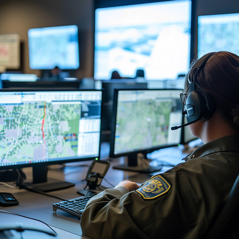
Before modern wireless location systems, emergency response depended more heavily on callers knowing where they were, dispatchers interpreting landmarks, and responders searching from incomplete information. That was especially difficult for mobile callers, visitors, rural incidents, crashes, trails, and large campuses.
Today, phones, vehicles, dispatch systems, responder radios, and fleet platforms can all contribute location data. GPS is central, but emergency location also uses network-based methods, indoor information, maps, address databases, and operational judgment.
FCC wireless E911 location rules address location accuracy for mobile 911 callers, and GPS.gov highlights emergency vehicles among transportation uses improved by GPS. Inference: emergency response benefits most when location data is timely, trusted, and integrated into dispatch workflows instead of arriving as an isolated coordinate.
10. Aviation Navigation
Aviation uses GPS as part of a certified navigation environment where accuracy, integrity, availability, procedures, avionics, and fallback planning matter as much as the position fix itself.
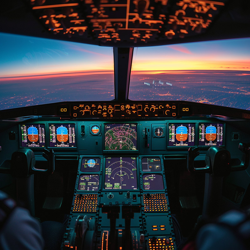
Before GPS became central to aviation navigation, aircraft depended on ground-based navigation aids, airways, radar vectors, inertial systems, visual references, and radio procedures. Those systems still matter, but satellite navigation has expanded route flexibility and approach options.
GPS supports area navigation, direct routing, instrument procedures, situational awareness, and flight-management systems. Augmentation systems such as WAAS improve accuracy and integrity for properly equipped receivers and approved procedures.
The FAA says WAAS provides augmentation information to GPS/WAAS receivers to improve the accuracy and integrity of position estimates, and GPS.gov notes that aviation is a key safety-of-life application for modernized civil GPS signals. Inference: aviation GPS is the clearest reminder that navigation is not just knowing where you are; it is knowing how trustworthy that answer is for the operation being flown.
What Makes GPS Work Better
- Multi-constellation receivers: many devices use GPS along with other GNSS constellations for more available satellites and better performance in difficult environments.
- Augmentation and corrections: WAAS, RTK, differential correction, and other services can improve accuracy and integrity for specific applications.
- Sensor fusion: phones, cars, drones, and wearables blend satellite positioning with inertial sensors, maps, cameras, barometers, cellular, and Wi-Fi signals.
- Good maps and workflows: a position fix is only useful when it connects to roads, trails, fields, dispatch records, airspace, assets, or business rules.
- Resilience planning: terrain, buildings, interference, spoofing, jamming, battery limits, and outages make fallback methods and user judgment important.
GPS is strongest when it is treated as infrastructure rather than magic. It gives systems a shared sense of position and time. The application then has to decide what that position means: turn here, dispatch there, avoid overlap, return home, mark the waypoint, find the caller, or fly the procedure.
Sources and 2026 References
- GPS.gov: GPS
- GPS.gov: GPS Accuracy
- GPS.gov: Driving with GPS
- GPS.gov: GPS and Efficient Flying
- GPS.gov: Precision Agriculture with GPS
- NOAA National Geodetic Survey: What is GPS?
- NIST: How do you measure your location using GPS?
- USDA ARS: Benefits and Evolution of Precision Agriculture
- FAA: Satellite Navigation - GPS - How It Works
- FAA: Satellite Navigation - WAAS - How It Works
- FAA: Unmanned Aircraft Systems
- FCC: Wireless E911 Location Accuracy Requirements
Related Yenra Articles
- RFID Technologies covers another identification layer used in logistics, retail, transportation, and access control.
- Transportation Tracking looks at how location data becomes operational visibility.
- Drone Technology explores autonomous and semi-autonomous systems that depend on reliable positioning.