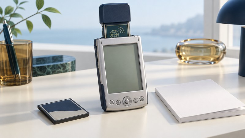
CompactFlash GPS turned an expandable handheld computer into part of a navigation system. The receiver supplied position information; the Pocket PC supplied the screen and computing; software and map data made that position useful. Reconstructing one of these systems means checking the whole combination.
TeleType’s WorldNavigator belongs to this early-2000s era of PDA navigation. For a collector, the useful question is what an identifiable receiver and host can demonstrate with the documentation and software that remain. Start with model labels and manuals rather than a broad compatibility claim from a product announcement.
Separate the receiver from storage and communication
A GPS receiver card and a CompactFlash storage card perform different jobs. One receives satellite signals and produces navigation data; the other stores files. A host may need maps stored elsewhere if its available expansion slot is occupied by the receiver. Record the actual slot arrangement before assuming two cards can be used together.
The word “wireless” can describe receiving satellite broadcasts or avoiding an external receiver cable. Remote tracking additionally needs a way to send a position to another person or service. Treat that communications path as a separate dependency when interpreting old claims. The GPS systems explanation describes how satellite reception becomes a position; asset tracking adds the reporting connection.
Let the exact manual narrow the claim
The archived TeleType product 1390 installation manual, reproduced by ManualsLib, specifies a CompactFlash Type II/PCMCIA arrangement and notes an expansion-jacket requirement for Compaq iPAQ. It also identifies NMEA 0183 v2.0 output. Those details describe that product’s intended configuration; they are useful questions to check against a particular specimen.
Physical fit is one checkpoint. The host still needs the appropriate operating system, a usable device interface and software that can read the receiver’s output. A modern USB storage-card reader needs explicit support for a legacy GPS I/O card before it can serve that role. Verify the interface in the documentation before treating an adapter as a solution.
| Dependency | Evidence to find | Useful result |
|---|---|---|
| Card and host | Exact models, slot type, required jacket or adapter | A documented physical and electrical pairing |
| Operating system | OS version and applicable installation instructions | A supported historical software environment |
| Receiver input | Driver, port, protocol and settings specified for the combination | Navigation software can obtain receiver data |
| Maps | Product, region, release, storage location and license evidence | The installed program can display the intended area |
| Reporting | Separate network hardware and service, if required | A documented way to transmit a position |
Test one dependency at a time
Preserve accessible maps and personal data before changing software. Inspect connectors and identify the documented power arrangement. If instructions or a required driver are missing, record the gap before attempting installation. Use software with an identifiable source and documented applicability.
For a supported, working combination, first establish that the host recognizes the card. Then use the navigation program’s documented receiver-status view to establish that data arrives. Finally check whether a position fix is shown under appropriate open-sky conditions and whether the expected map can display it. Write down the exact symptom at each stage.
Illustrative diagnosis: a PDA displays a map but its position marker never changes. That establishes that some map data is available. Next inspect receiver input and fix status. If data is arriving but no valid position is reported, investigate reception and receiver state; if no input is available, return to the card, driver and port documentation.
Choose the outcome the evidence supports
Use the CompactFlash compatibility worksheet to distinguish verified components, missing dependencies and untested functions. A complete display exhibit, a working receiver demonstration and a dependable navigation tool are different outcomes. A small, documented success is valuable even when the original end-to-end system cannot be restored.
For comparison, the Garmin iQue 3600 integrated the receiver into the PDA. For a contemporary external-receiver workflow, see Bluetooth GPS compatibility and setup; its connection method requires its own checks.