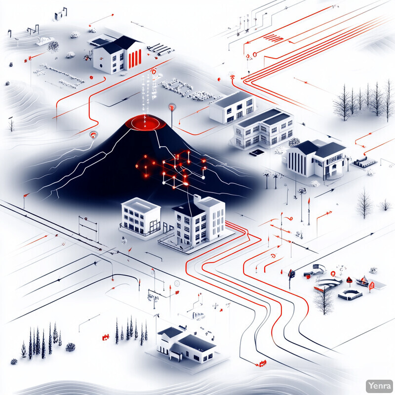
Volcano eruption risk assessment gets stronger with AI when the word "prediction" is used carefully. Exact deterministic prediction of when a volcano will erupt remains unsolved. In 2026, the strongest gains come from better detection of unrest, faster integration of InSAR, seismic, gas, thermal, and camera data, more useful probabilistic forecasts, and cleaner operational handoffs to observatories, aviation systems, and emergency planners.
That matters because volcanic crises are usually a timing and uncertainty problem. Teams have to decide whether swarms, deformation, degassing, plume growth, or low-frequency acoustic signals are ordinary background behavior or the start of a meaningful escalation. AI is becoming useful where it can compress those signals into earlier recognition, clearer probabilities, and faster updates rather than pretending to remove scientific uncertainty.
This update reflects the category as of March 19, 2026. It focuses on the parts of the field that feel most real now: data assimilation, anomaly detection, transfer learning for data-scarce volcanoes, trustworthy deformation detection, ash and SO2 retrieval, infrasound analysis, edge monitoring, scenario reduction, and machine-readable alerting connected to remote sensing, sensor fusion, spectroscopy, and time series forecasting.
1. Multimodal Data Assimilation
The clearest AI win in volcanology is combining many weak signals into one stronger operational picture. Volcanoes rarely announce themselves through just one channel, so models that fuse seismicity, deformation, gas, thermal output, imagery, and field observations are usually more useful than single-sensor alarms.

A 2024 Nature Communications study on the 2022 Mauna Loa eruption combined six monitoring data types with mineral chemistry and fluid-inclusion evidence and concluded that a roughly two-month period of sustained intrusion triggered the eruption. Inference: the field is moving toward integrated eruption narratives, not isolated metrics, and AI becomes most valuable when it helps observatories update that combined picture continuously.
2. Real-Time Precursor Detection From Continuous Seismic Data
Continuous seismic streams remain one of the fastest ways to detect rising unrest, and AI is getting better at finding subtle precursors that are too weak, too frequent, or too tedious to track manually around the clock.

A 2025 Nature Communications paper found that a jerk-based early-warning approach at Piton de la Fournaise provided timely warnings for 92% of 24 eruptions, with lead times ranging from minutes to 8.5 hours and false alarms near 14%. Inference: the near-term opportunity is not a universal magic signal, but stronger continuous-change detection on streams observatories already collect.
3. Transfer Learning for Data-Scarce Forecasting
Most volcanoes do not have the luxury of long, clean, eruption-rich training data. Transfer learning matters because it lets the field reuse signal patterns learned at well-instrumented volcanoes and apply them more cautiously at places with sparse histories.
In 2025, researchers reported a transfer-learning workflow trained on 41 eruptions from 24 volcanoes spanning about 73 years of seismic record and achieved area-under-curve performance around 0.8 on unseen target volcanoes. A related 2024 Frontiers paper argued that seismic-feature-based models can generalize across volcanoes and forecast eruptive probability from hours to days. Inference: one of the strongest directions now is cross-volcano learning, especially where local labels are scarce.
4. Weakly Supervised Catalog Improvement
A big share of volcano AI progress is quietly happening before forecasting even begins. Better event catalogs, cleaner labels, and automated triage of weak or ambiguous traces make every downstream forecast model more useful.

A 2025 Natural Hazards and Earth System Sciences study showed that pre-trained and weakly supervised approaches could recognize some seismo-volcanic event classes at rates up to about 90% while also surfacing traces that had been unannotated or misannotated in catalogs from Deception Island, Popocatepetl, and Tajogaite. Inference: one of AI's most realistic benefits is making the historical record itself richer and less error-prone.
5. InSAR, GNSS, and Trustworthy Deformation Detection
Ground deformation is one of the most valuable eruption precursors, but it is also noisy, data-heavy, and easy to misread. AI becomes especially useful here when it speeds up screening while still showing why a deformation signal looks real rather than atmospheric or processing noise.

A 2026 Bulletin of Volcanology paper on Hawaii used multimodal deep learning across GNSS and InSAR, detected both slow and fast deformation, separated atmospheric noise, and showed through explainability analysis that the model was using geophysically meaningful features. The GNSS branch also detected noteworthy changes months before the 2022 eruption. Inference: the next step is not just automatic detection, but trustworthy detection that analysts can interrogate.
6. Probabilistic Multi-Sensor Eruption Forecasting
Operational forecasting gets stronger when models output evolving probabilities instead of binary claims. That lets observatories see whether risk is climbing, flattening, or falling as new sensor evidence arrives.
A 2025 Geophysical Research Letters study built a Bayesian multi-sensor eruption-forecasting model for Whakaari using tremor, earthquake rate, and CO2, SO2, and H2S data. The system showed probability increases months to weeks before three eruptions and remained useful under sensor outages. Inference: the most practical volcano forecasting systems are becoming probabilistic, interpretable, and resilient rather than purely black-box classifiers.
7. Ash Cloud Detection and Plume Segmentation
Ash monitoring is one of the most operationally mature volcano AI applications because it has a direct path to aviation safety, plume tracking, and downwind public health decisions.
A 2024 Journal of Volcanology and Geothermal Research paper showed that convolutional neural networks can improve automated volcanic-ash detection from satellite imagery, and another 2024 Sabancaya study combined seismic and visual data for near-real-time multiparametric monitoring of explosions and plumes. Inference: the field is moving from manual plume watching toward automated segmentation and cross-checking across image and waveform streams.
8. Infrasound and Acoustic Monitoring
Volcanoes do not only shake the ground. They also radiate low-frequency sound that can help detect explosions, vent changes, and eruptive pulses when visibility is poor or other sensors are ambiguous.

A 2024 Journal of Geophysical Research: Solid Earth paper showed deep learning could jointly detect and characterize seismic and acoustic signals at Pavlof Volcano, Alaska. Then a 2025 JVGR study at Semisopochnoi tracked magma-ascent pulses across multidisciplinary data, documented six weeks of precursory activity, and identified hundreds of similar infrasound waveforms over more than a year. Inference: infrasound is becoming a stronger, not weaker, part of AI-assisted volcano monitoring.
9. Thermal Hotspot Mapping and Effusive Activity Monitoring
Thermal analysis is one of the fastest ways to track open-vent activity, lava extrusion, and elevated heat output. AI helps most when cloud gaps, sensor cadence, and false detections would otherwise make thermal monitoring inconsistent.

A 2024 Remote Sensing paper on near-real-time volcanic radiative-power estimation used remote-sensing data fusion to cut omission rates from 75.5% to 3.7% overall while also reducing false detections. A second 2024 study introduced HotLINK for automatic hotspot identification in Alaska. Inference: AI is turning thermal monitoring from a patchy alerting layer into a more reliable quantitative workflow.
10. Gas, SO2, and Geochemical Signal Recognition
Gas monitoring matters because erupting systems often change chemically before they change visually. AI is now helping observatories extract more consistent SO2 and degassing information from satellites and large atmospheric datasets.

A 2024 Remote Sensing of Environment paper used TROPOMI and AI to quantify daily volcanic SO2 emissions across systems including Etna, Villarrica, Fuego, Pacaya, and Cumbre Vieja, and a 2025 Remote Sensing study proposed a faster global-scale workflow in Google Earth Engine using segmentation and clustering. Inference: AI is making volcanic gas intelligence more routine, more scalable, and less dependent on slow manual screening.
11. Edge and On-Device Monitoring
Some volcanoes are remote, communication links are fragile, and the first useful decision may need to happen near the sensor rather than in a distant data center. That makes low-power and edge-capable AI especially valuable.

A 2024 Electronics paper on Copahue Volcano reported an edge-oriented seismic-event-detection workflow with about 140 milliseconds for feature extraction, 0.00025 milliseconds for FPGA inference, roughly 1 millisecond for transfer overhead, and power use near 1.5 watts. Inference: there is real progress toward observatory networks that do not need full-bandwidth cloud connectivity to detect meaningful local activity.
12. Fast Scenario Generation for Contingency Planning
Hazard planning is often limited by how many simulations teams can run before a meeting, an alert, or an aviation decision. Surrogate models matter because they make many more plausible scenarios computationally affordable.
A 2023 Computers & Geosciences paper showed that Gaussian-process statistical surrogates could support probabilistic volcanic mass-flow hazard assessment at negligible computational expense relative to repeated deterministic runs. Inference: one of the strongest planning uses of AI is not replacing physics, but making physics-heavy scenario work fast enough for operational decisions.
13. Eruption Sequence Reconstruction Across Long Unrest Cycles
AI gets more useful when it can connect long unrest histories to short acute crises. That means recognizing how intrusion, seismicity, deformation, gas, and ash signals fit together over months or even years rather than only around one eruption date.
The 2025 Semisopochnoi study reconstructed a longer eruption lifecycle from multidisciplinary records, linking the 2018-2023 phreatomagmatic activity back to earlier intrusion, seismicity, InSAR, SO2, and ash evidence, while identifying six weeks of clear precursory activity before explosive phases. Inference: AI-assisted reconstruction is increasingly useful not just for warning, but for understanding how a volcanic system actually evolves across time.
14. Automated Alert Generation and Machine-Readable Notices
Forecast skill only matters if it reaches decision-makers quickly and in a format their systems can use. Alert automation is therefore becoming a core part of volcano AI, especially for aviation-facing workflows where minutes matter.
A 2024 Bulletin of Volcanology paper described a computer-assisted procedure for compiling VONA messages with the goal of getting information to volcanic-ash advisory centers and air-traffic offices within 5 to 10 minutes. Then on March 4, 2026, USGS announced updated aviation-focused Volcano Observatory Notices for Aviation using standardized language and machine-readable formatting. Inference: the operational frontier is increasingly about turning monitoring outputs into structured decision products.
15. Social Sensing and Crowdsourced Observations
Instruments do not capture everything, especially during fast-changing crises. Carefully filtered eyewitness observations, photographs, and social posts can extend the monitoring record and improve situational awareness when formal sensors are sparse or delayed.

A 2024 Communications Earth & Environment paper showed that 1,930 crowdsourced observations expanded and enhanced volcano monitoring records, while a 2025 NHESS study on the 2018 Kilauea eruption found that social-sensing workflows captured meaningful signals about hazards, mitigation, and damage. Inference: human reports are becoming a legitimate supplemental data layer when combined with validation and context.
Related AI Glossary
- InSAR explains the satellite deformation mapping that now feeds many volcano-monitoring pipelines.
- Infrasound covers the low-frequency acoustic signals that help detect explosions, venting, and eruptive pulses.
- Remote Sensing broadens the satellite and airborne observation layer behind ash, thermal, and SO2 monitoring.
- Data Assimilation matters when seismic, deformation, gas, and atmospheric evidence must be folded into one updated state estimate.
- Sensor Fusion explains why observatories increasingly combine many imperfect data streams instead of trusting one alone.
- Anomaly Detection helps explain how systems spot unusual tremor, gas, or deformation behavior against a shifting baseline.
- Spectroscopy matters for gas and spectral retrieval workflows that identify chemical change rather than just visual change.
- Source Apportionment is useful when plume chemistry and atmospheric transport need to be traced back to specific volcanic emissions.
- Geographic Information System (GIS) is the spatial workspace where hazard layers, vents, plumes, and exposed infrastructure come together.
- Time Series Forecasting helps frame how observatories turn evolving unrest into updated risk windows rather than one-off judgments.
Sources and 2026 References
- Nature Communications: Triggering the 2022 eruption of Mauna Loa.
- Nature Communications: Jerk, a promising tool for early warning of volcanic eruptions.
- Nature Communications: Ergodic seismic precursors and transfer learning for short term eruption forecasting at data scarce volcanoes.
- Frontiers in Earth Science: Universal machine learning approach to volcanic eruption forecasting using seismic features.
- NHESS: Could seismo-volcanic catalogs be improved or created using weakly supervised approaches with pre-trained systems?.
- Bulletin of Volcanology: Detecting volcanic deformation in Hawaii using trustworthy multimodal deep learning techniques.
- Remote Sensing: Deep Learning for Automatic Detection of Volcanic and Earthquake-Related InSAR Deformation.
- Geophysical Research Letters: Probabilistic, Multi-Sensor Eruption Forecasting.
- Nature Communications: Automatic precursor recognition and real-time forecasting of sudden explosive volcanic eruptions at Whakaari, New Zealand.
- JVGR: Enhancing detection of volcanic ash clouds from space with convolutional neural networks.
- JVGR: Near-real-time multiparametric seismic and visual monitoring of explosive activity at Sabancaya volcano, Peru.
- JGR Solid Earth: Detection and characterization of seismic and acoustic signals at Pavlof Volcano, Alaska, using deep learning.
- JVGR: Identifying precursors and tracking pulses of magma ascent in multidisciplinary data during the 2018-2023 phreatomagmatic eruption at Semisopochnoi Island, Alaska.
- Remote Sensing: Advancing Volcanic Activity Monitoring: A Near-Real-Time Approach with Remote Sensing Data Fusion for Radiative Power Estimation.
- Frontiers in Earth Science: Automatic identification and quantification of volcanic hotspots in Alaska using HotLINK.
- Remote Sensing of Environment: Quantifying volcanic SO2 emissions with Sentinel-5 TROPOMI and Artificial Intelligence.
- Remote Sensing: A New Algorithm for the Global-Scale Quantification of Volcanic SO2 Exploiting the Sentinel-5P TROPOMI and Google Earth Engine.
- Electronics: Seismic Event Detection in the Copahue Volcano Based on Machine Learning: Towards an On-the-Edge Implementation.
- Computers & Geosciences: Probabilistic volcanic mass flow hazard assessment using statistical surrogates of deterministic simulations.
- Geoscientific Model Development: Volcanic ash forecast using ensemble-based data assimilation coupled with FALL3D-7.2.
- Bulletin of Volcanology: A fast compilation of the VONA messages using a computer-assisted procedure.
- USGS: USGS to Launch Updated Aviation-Focused Volcano Notices in March 2026.
- USGS: Introduction to recommended capabilities and instrumentation for volcano monitoring in the United States.
- NHESS: Social sensing a volcanic eruption: application to Kilauea, 2018.
- Communications Earth & Environment: Crowdsourcing human observations expands and enhances volcano monitoring records.
Related Yenra Articles
- Seismic Activity Prediction covers another earth-system hazard where signal detection, deformation, and operational warning have become more AI-assisted.
- Disaster Response follows eruption warning into triage, logistics, evacuation support, and emergency coordination.
- Geospatial Analysis adds the map, remote-sensing, and spatial-data workflow behind plume tracking and hazard layers.
- Atmospheric Science and Climate Modeling connects eruptions to plume movement, transport modeling, and downwind impacts.