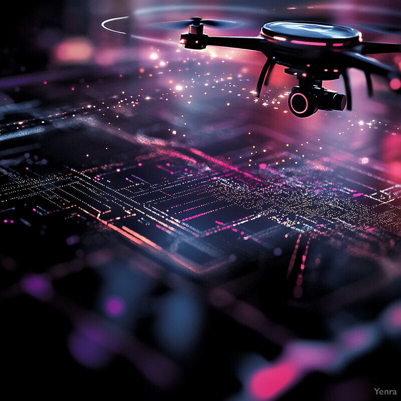
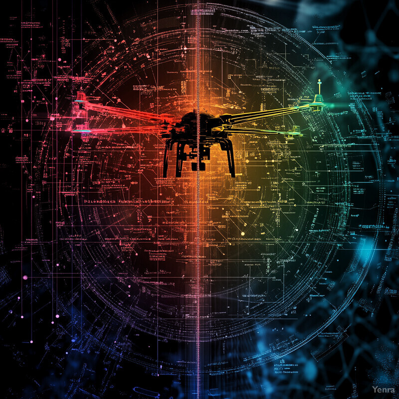
Drone threat detection gets stronger in 2026 when it is treated as a bounded counter-UAS sensing and coordination problem, not as a promise of autonomous shootdowns. The strongest systems combine computer vision, sensor fusion, cognitive radar, beamforming, trajectory prediction, and Remote ID into workflows that help teams detect, track, identify, and prioritize suspicious aircraft faster.
The legal boundary matters as much as the model boundary. FAA and DOJ guidance keeps pointing to the same operational truth: broad detection, identification, and conformance monitoring are useful, but mitigation authority is narrow and context-specific. That makes AI most valuable as a cueing, filtering, and evidence-building layer that helps authorized teams move faster with better data.
This update reflects the category as of March 22, 2026. It focuses on the counter-UAS work that feels most credible now: long-range sensing, RF and radar correlation, Remote ID analysis, perimeter inference, swarm tracking, and command-center decision support.
1. Small-Target Visual Detection
Visual drone detection is getting stronger because models are now tuned for tiny, low-contrast targets instead of assuming a drone will fill a meaningful part of the frame.
The 2024 Drones survey on vision-based drone detection and 2025 long-range detection work in Scientific Reports both center the same problem: drones are small, visually weak, and easy to confuse with background clutter or birds. Inference: the practical gain in 2026 is not generic object detection alone but architectures tuned for tiny targets, long focal lengths, and early cueing for other sensors.
2. Real-Time Drone Identification and Bird Filtering
Real-time identification gets more useful when systems classify likely drones quickly enough to separate them from birds, balloons, and other nuisance tracks before operators lose time.

The European Commission's Joint Research Centre frames counter-UAS around a detection, tracking, and identification chain, while the 2024 drone-vision survey highlights how birds, branches, skyline clutter, and weak target appearance drive false alarms. Inference: strong 2026 systems do not rely on one classifier alone; they use fast optical, RF, and radar cues together to reduce nuisance alerts before escalation.
3. Long-Range Optical Tracking
Long-range optical tracking is improving because detection models are being paired with tracking logic that preserves a weak target across many frames instead of demanding one perfect frame.
Recent long-range drone-detection research shows why this remains difficult: at distance, a target may occupy only a handful of pixels and may fade in and out with shimmer, motion blur, or clutter. The strongest systems therefore combine small-object detection with track persistence and operator review rather than treating visual confidence as a one-shot decision.
4. Thermal and Low-Light Tracking
Thermal and visible-thermal fusion are making night and low-visibility drone tracking more credible, especially when visual-only systems would otherwise wash out.

The 2024 survey of drone vision methods and a 2024 Drones paper on visible-thermal drone detection both reinforce the same pattern: visible cameras remain information-rich in good light, while thermal sensing stays useful when illumination drops or camouflage increases. Inference: thermal is strongest as a fused confirmation layer, not as a universal replacement for daylight optics.
5. RF Detection and Controller Fingerprinting
RF detection remains one of the fastest ways to tell that a real command link is present, and machine learning is making those signatures easier to classify in noisy conditions.

A 2025 Scientific Reports paper on RF-based UAV recognition reported strong classification performance across signal-to-noise conditions, including roughly 90% recognition at 0 dB and near 98% at higher SNRs. Inference: RF remains a high-value early warning layer, especially for controller discovery, emitter classification, and operator localization, even though it cannot see radio-silent aircraft on its own.
6. Remote ID Correlation and Identity Resolution
Remote ID becomes operationally useful when AI correlates the broadcast identity and location stream with airspace rules, local sensors, and registration or incident workflows.
FAA describes Remote ID as the drone's broadcast identification layer, while GAO's 2024 review makes clear that law-enforcement value depends on better interfaces, real-time access, and clearer operational support. Inference: Remote ID is not the whole answer; it is the cooperative identity layer that AI can merge with RF, optical, and map context to decide whether a track is compliant, suspicious, or worth escalating.
7. Radar and Micro-Doppler Detection
Radar keeps getting stronger in counter-UAS because it can hold up in poor lighting and give noncooperative target evidence even when cameras and RF are incomplete.

A 2025 Drones study on compact 24 GHz hybrid beamforming radar reported experimental validation for small-drone detection across wide azimuth and elevation coverage. The JRC counter-UAS report likewise treats radar as a core part of the detection, tracking, and identification stack. Inference: radar is most valuable in 2026 when AI turns raw returns into track quality, micro-motion cues, and fusion-ready evidence instead of leaving it as a standalone alarm stream.
8. Multi-Sensor Data Fusion
Multi-sensor fusion matters because no single counter-UAS sensor is reliable enough across range, weather, clutter, and aircraft behavior.

The JRC counter-drone report explicitly highlights multi-sensor data fusion as a requirement for real-time detection, tracking, and identification, and recent 2024 sensor-fusion work shows RF-plus-acoustic combinations improving robustness where one modality degrades. Inference: the most credible 2026 systems are not sensor replacements but correlation engines that raise confidence while cutting false alarms.
9. Acoustic Arrays and Beamforming
Acoustic detection is becoming more useful as a supporting layer because beamforming and learned classifiers can pick out rotor signatures where line of sight is poor.

Fraunhofer's 2025 acoustic drone-detection work stresses that acoustics complements radar, cameras, and lidar because it can still detect and localize aircraft when visual contact is blocked. The JRC sensor review points the same direction: acoustics is rarely enough alone, but it becomes valuable when fused with the rest of the stack.
10. Flight Path Prediction and Trajectory Verification
The most practical trajectory use case today is often verifying whether a drone is staying on an allowed path, not pretending to forecast every future maneuver perfectly.

The ORION framework shows where this is heading operationally: using live Remote ID messages to verify whether an aircraft remains consistent with an allowed trajectory. Inference: trajectory AI is strongest when it supports conformance monitoring, early warning, and operator decision support rather than a fragile promise of exact long-horizon prediction.
11. Behavioral Anomaly Detection
Behavioral anomaly detection is getting stronger because teams can now compare live drone behavior against mission rules, sensor relationships, and airspace expectations instead of relying only on simple no-fly-zone checks.

A 2025 runtime anomaly-detection paper for drones reported 93.84% anomaly detection across six fault types with a 2.33% false-positive rate by combining rule mining with unsupervised models. ORION reaches a similar operational theme from the airspace side by checking whether observed behavior remains conformant. Inference: the best 2026 anomaly layers mix rules with learned models so teams can explain why a track was flagged.
12. Geofence and Restricted-Airspace Alerts
Geofence intelligence gets more operationally useful when AI turns raw location data into context-aware alerts tied to TFRs, protected sites, and local operating rules.

FAA already provides the policy layers that these systems have to respect, including Remote ID, TFRs, and public-safety operational guidance. Inference: AI adds value by map-matching uncertain tracks, prioritizing boundary violations near sensitive assets, and reducing alert overload when many objects are present at once.
13. Swarm Detection and Density Tracking
Swarm detection is improving because tracking systems are getting better at recognizing many drones as a coordinated group instead of as isolated single-target events.
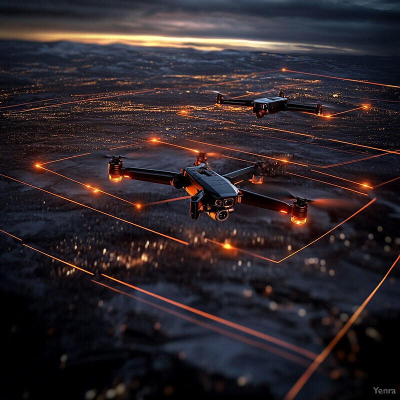
The 2025 LiSWARM work is a useful signal here: it reported recognition accuracy up to 98% and around 94% overall in dense drone-show settings, including experiments with 150- and 500-drone groups and tracking delays in the tens of milliseconds. Inference: malicious-swarm defense remains hard, but dense multi-drone tracking is becoming technically plausible enough to matter for counter-UAS planning.
14. Edge Inference at the Perimeter
Edge inference is making counter-UAS deployments stronger because detection can happen on local sensors and perimeter devices without waiting for a distant cloud round-trip.
A 2024 Drones paper on Jetson Nano deployment reported roughly 72.5 FPS for YOLOv9-based drone detection while maintaining strong precision and mAP. Inference: the best edge architecture in 2026 is not a cloud replacement but a layered system where the edge handles first-pass detection and the command center handles fusion, investigation, and policy decisions.
15. Contextual Threat Prioritization
Threat prioritization gets stronger when AI ranks detections by context such as location, intent, identity confidence, group behavior, and likely consequence instead of treating every drone equally.

Army aided-target-recognition work on small UAS is explicitly aimed at reducing operator fatigue and helping teams nominate higher-priority targets faster, while DOJ's interagency advisory makes clear that legal and operational judgment still matters before mitigation. Inference: prioritization is one of the most defensible near-term uses of AI in counter-UAS because it shortens human review without pretending to replace it.
16. Data-Driven Vulnerability Assessment
Data-driven vulnerability assessment helps teams understand where a site is easiest to approach, what the sensors can miss, and which zones deserve the most coverage.

The JRC counter-UAS report lays out the strengths and weaknesses of major sensing modalities, while FAA public-safety guidance organizes counter-drone operations around specific public venues, airspace constraints, and response roles. Inference: good 2026 systems use historical detections, site geometry, and sensor-performance limits to decide where to place coverage and where residual risk remains.
17. Adaptive Learning for Evolving Threats
Adaptive learning matters because counter-UAS models degrade quickly if they are frozen while aircraft designs, backgrounds, RF conditions, and attack patterns keep changing.

The 2024 drone-detection survey repeatedly identifies data scarcity, uneven dataset quality, changing environments, and poor real-world generalization as open issues. The 2025 RADD paper reinforces that runtime monitoring still needs interpretable rules when new conditions appear. Inference: the strongest systems in 2026 are built around retraining, validation, and drift checks, not a one-time model drop.
18. Incident Response Coordination
Detection only becomes operationally valuable when alerts flow into the right responder workflow with enough structure for investigation, escalation, and after-action review.

GAO's 2024 Remote ID review is largely about operational support, interfaces, and law-enforcement usability, and FAA's public-safety toolkit is organized around practical workflows rather than abstract detection theory. Inference: the most credible deployments in 2026 treat incident routing, evidence packaging, and responder handoff as core product features.
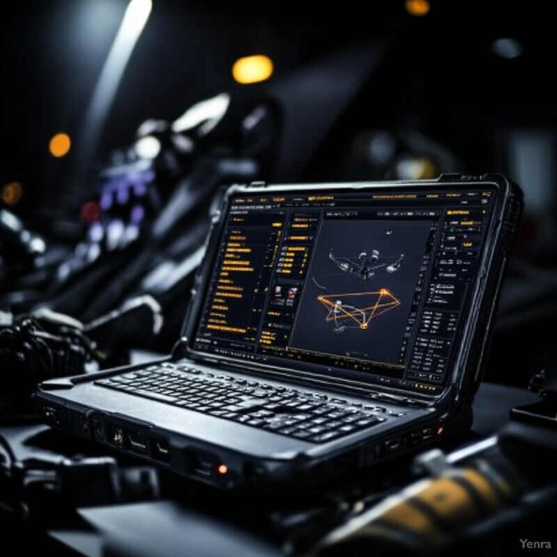
19. Enhanced Situational Awareness and Common Operating Pictures
Common operating pictures get stronger when AI condenses many feeds into a shared track layer that commanders and field teams can understand quickly.

Army C5ISR's 2025 aided-target-recognition work shows why this matters: the stated goal is to reduce fatigue, improve situational awareness, and pass actionable threat information back through the existing common operating picture. FAA's public-safety toolkit points to the same operational pattern in civilian settings. Inference: counter-UAS AI is strongest when it clarifies the picture for humans already responsible for the response.
20. Authorized Response and Mitigation Cueing
Authorized response gets stronger when AI cues lawful mitigation options and preserves the evidence trail, rather than acting as if every suspicious drone can be jammed or intercepted automatically.

DOJ's interagency advisory states plainly that non-federal public and private entities generally do not have the legal authority to use counter-UAS mitigation technologies. FAA guidance likewise centers safe airspace integration and identification. Inference: the defensible AI role in 2026 is cueing options, preserving evidence, and helping authorized teams respond faster within the law.
Related AI Glossary
- Remote ID explains the drone broadcast identity layer that modern counter-UAS systems increasingly use for conformance checks and live correlation.
- Swarm Intelligence helps frame why groups of low-cost drones create a different detection and prioritization problem than isolated aircraft.
- Sensor Fusion anchors the multi-sensor correlation layer behind radar, RF, EO/IR, and acoustic counter-UAS workflows.
- Cognitive Radar helps explain adaptive radar sensing for small, low-observable aerial targets.
- Beamforming matters when acoustic or RF arrays need to localize weak signals in cluttered environments.
- Geofencing covers the virtual boundary logic behind restricted-airspace and perimeter alerts.
- Trajectory Prediction supports conformance monitoring, early warning, and route-risk analysis.
- Edge Computing explains why first-pass inference often has to happen on the perimeter instead of in a distant cloud.
- Anomaly Detection covers the behavioral and conformance-monitoring layer that helps teams spot unusual drone activity.
- Computer Vision underpins the optical and thermal detection stack for small airborne targets.
Sources and 2026 References
- FAA: Remote Identification of Drones.
- FAA: Public Safety Toolkit.
- FAA: Temporary Flight Restrictions.
- GAO: Actions Needed to Better Support Remote Identification in the National Airspace.
- DOJ: Interagency issues advisory on the use of technology to detect and mitigate UAS.
- European Commission JRC: Counter-drone systems and data fusion.
- Scientific Reports: Improved YOLO for long range detection of small drones.
- Scientific Reports: Radio frequency signal classification for UAV recognition.
- Drones: Vision-Based Drone Detection in Complex Environments: A Survey.
- Drones: Visible-Thermal Object Detection for Drones.
- Drones: Compact 24 GHz Hybrid Beamforming Radar for Small-Drone Detection.
- Sensors: RF and Acoustic Sensor Fusion for Drone Detection.
- Fraunhofer IDMT: Acoustic drone detection.
- Future Generation Computer Systems: ORION online trajectory verification with Remote ID.
- arXiv / ICECCS 2025: Runtime Anomaly Detection for Drones.
- MobiSys 2025: LiSWARM.
- Drones: Edge computing-driven real-time drone detection using YOLOv9 and NVIDIA Jetson Nano.
- U.S. Army: C5ISR Center research connects aided target recognition with small UAS.
Related Yenra Articles
- Intelligent Radar Signal Processing adds the radar-specific sensing and adaptive waveform context behind many counter-UAS deployments.
- Drone Technology covers the broader aviation, sensing, and airspace stack behind legitimate drone operations and the constraints counter-UAS systems must understand.
- Air Traffic Control Optimization extends the airspace-management side of trajectory prediction, conformance monitoring, and operator decision support.
- Drone Swarm Coordination explores the coordination logic that becomes relevant when many aircraft move as a group.
- Autonomous Infrastructure Inspections adds another operational setting where drone identity, path conformance, and perimeter awareness affect real-world decisions.
- Construction Site Safety Monitoring shows another environment where perimeter sensing, geofencing, and edge inference have to work reliably under real operational pressure.