Aerial imagery land management is strongest when AI is used as a measurement layer, not a magic-eye claim. In 2026, the most credible gains come from better remote sensing, faster change detection, cleaner orthomosaic generation, stronger photogrammetry, and tighter workflows that move imagery into a GIS fast enough to guide real land decisions.
That matters because land managers rarely need one more pretty image. They need parcel-scale land cover, field-by-field crop signals, fuel and flood evidence, invasive-species boundaries, forest structure, habitat condition, mine-restoration progress, and defensible map layers for permits, inspections, and recovery work. AI helps most when it shortens the path from image capture to map-ready interpretation without losing calibration, provenance, or human review.
This update reflects the category as of March 20, 2026. It focuses on the parts of the field that feel most real now: high-resolution classification, seasonal crop analytics, soil moisture and irrigation support, wildfire and shoreline monitoring, invasive-plant mapping, urban footprint tracking, forest biomass and carbon estimation, precision ranching, methane and compliance screening, mine reclamation, near-real-time orthomosaics, terrain reconstruction, and post-disaster damage review.
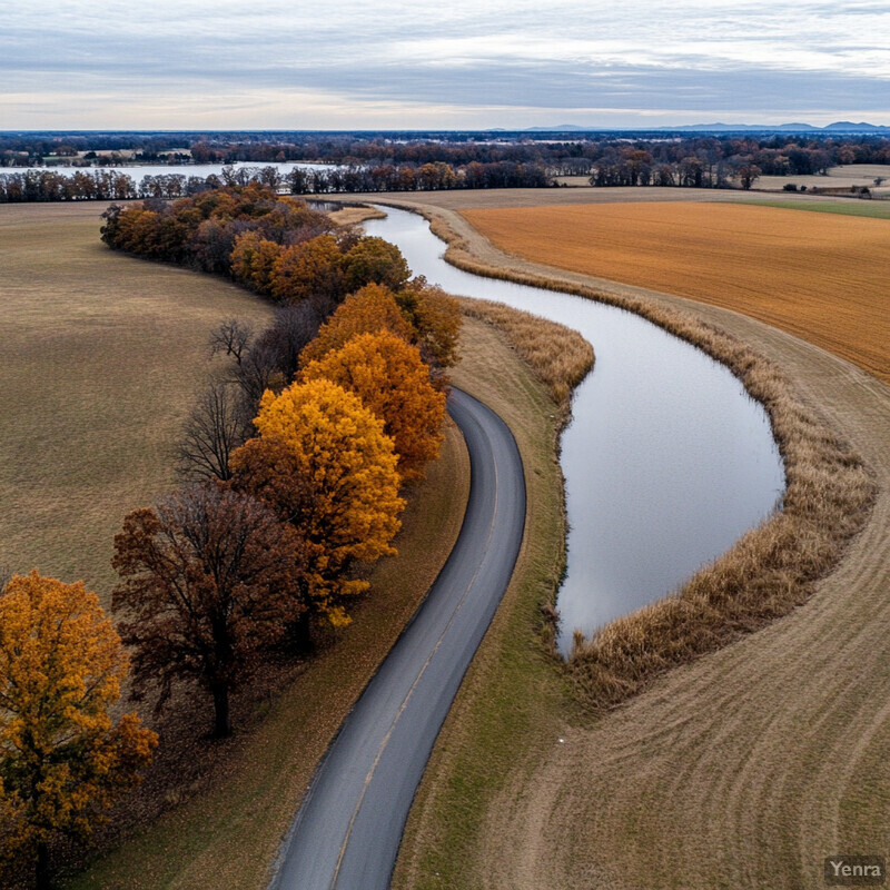
1. High-Resolution Land Classification
High-resolution classification is strongest when AI turns aircraft and drone imagery into stable land-cover layers that planners can measure, compare, and refresh. The real value is not generic image labeling. It is parcel-, habitat-, and corridor-scale mapping that is detailed enough to support land-use decisions.

A 2025 Scientific Data release introduced SCLC-map, a 1.5 m land-cover product for Southern California with reported pixel-wise accuracy of 88.83% and class-wise accuracy of 90.66%. A 2025 Remote Sensing study on very-high-resolution aerial imagery reported 84.25%-86.07% overall accuracy while compressing topographic map extraction from about 9 days of manual work to roughly 43 minutes. Inference: high-resolution aerial classification is now good enough to function as an operational base layer for land planning instead of a one-off research artifact.
2. Automated Change Detection
Change detection becomes useful when AI distinguishes true land change from seasonal, atmospheric, or alignment noise. The point is not merely to show that two images differ, but to reliably surface the changes that matter for compliance, restoration, hazard response, and long-horizon land review.
A 2025 Scientific Reports study used multi-year Sentinel-2 imagery with a deep learning ensemble network for land-use classification and temporal change review, explicitly pairing yearly classification with rate-of-change analysis. A second 2025 study in ScienceDirect focused on change detection in Sentinel-2 images using deep learning ensembles, reinforcing how ensemble methods can stabilize multi-temporal comparisons across scenes. Inference: AI change detection is maturing from demo segmentation toward repeatable monitoring workflows that can support year-over-year land management.
3. Precision Agriculture
Aerial imagery is most valuable in agriculture when it changes field actions, not when it simply produces colorful vigor maps. AI matters here when crop type, emergence, stress, and spatial variability can be translated into more targeted irrigation, fertilization, scouting, and harvest planning.
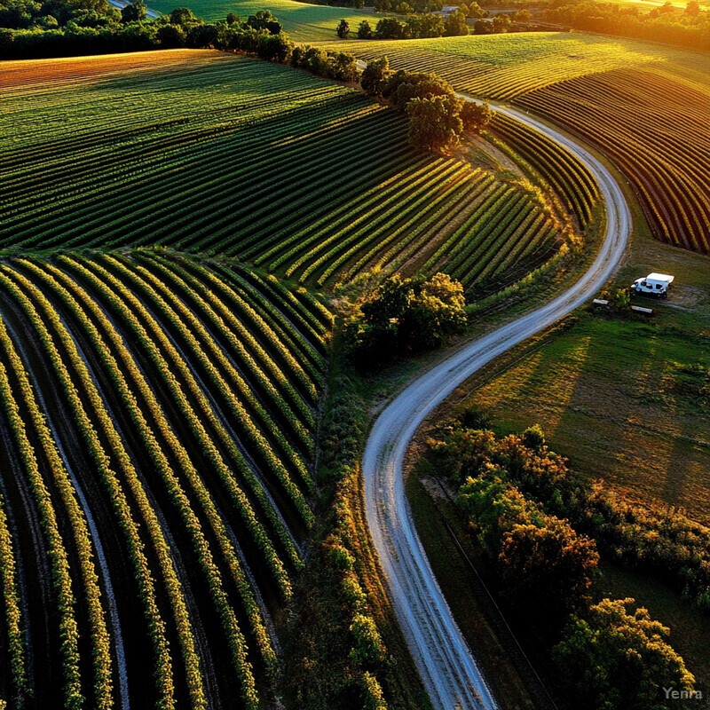
The 2025 CropSTS work argued that foundation models can outperform pure historical baselines in crop type segmentation, showing how geospatial pretraining is starting to matter in agricultural mapping. A 2025 Frontiers in Agronomy review also summarized how UAV-satellite fusion and machine learning are already improving yield prediction and disease detection timelines in practical precision-agriculture workflows. Inference: the field is moving beyond one-image crop scouting toward time-aware AI systems that use repeated aerial observation as decision support.
4. Vegetation Health Monitoring
Vegetation-health monitoring gets stronger when AI fuses visible, multispectral, and thermal signals into maps that reveal stress before it becomes obvious on the ground. What matters is not just detecting green versus brown, but separating water stress, vigor decline, and within-field variability early enough to act.
An ISPRS Annals 2025 study compared UAV multispectral and thermal imagery for crop-health and water-stress estimation in citrus fields, illustrating the practical role of multimodal scouting flights. In early 2026, Computers and Electronics in Agriculture reported that generative RGB-to-synthetic-thermal models can support crop water-stress assessment from standard UAV imagery collected across 32 experimental plots over three seasons. Inference: aerial vegetation monitoring is shifting from simple index mapping toward richer sensor substitution and cross-modal interpretation.
5. Soil Moisture and Irrigation Planning
Soil-moisture and irrigation analytics get stronger when imagery is used to decide where water is truly needed, not just where a field looks dry. AI is most helpful when it connects surface patterns to sensor placement, water-balance thinking, and field-specific irrigation scheduling.

A 2024 Land study combined Sentinel-1 SAR with machine learning to optimize soil-moisture sensor placement at catchment scale, showing that remote sensing can reduce blind spots before irrigation models are even built. The Crop Science Society of America then highlighted 2025 work using UAS multispectral and thermal imagery with machine-learning models to estimate high-resolution actual evapotranspiration and turf quality for site-specific irrigation. Inference: aerial irrigation support is strongest when imagery informs both sparse sensing strategy and ongoing ET-driven water management.
6. Wildfire Risk Assessment and Management
Wildfire imagery is strongest when AI supports the full cycle from fuel-risk screening to active-fire mapping and post-fire review. The useful question is not whether fire can be seen from above. It is whether land managers can react faster to where ignition, spread, or recovery risk is actually changing.

NASA documented in 2025 how wildfire maps derived from airborne sensing helped firefighters in real time by showing fire boundaries clearly enough to guide tactical action. A 2025 Scientific Reports paper on lightning-ignited wildfire prediction used explainable machine learning to model where wildfire risk is likely to increase under changing climate conditions. Inference: AI wildfire work is becoming more operational when aerial imagery is connected to both immediate response and longer-term land-management planning.
7. Coastal Erosion and Flooding Analysis
Coastal and flood analysis improves when AI extracts boundaries, inundation extents, and elevation-linked change fast enough to support protection and recovery work. The practical challenge is handling water movement, tides, cloud cover, and terrain complexity without losing spatial trust.

A 2025 coastal-monitoring paper from Portugal used UAV aerial photogrammetry to generate high-precision models for shoreline and erosion review across repeat missions. In parallel, an EGUsphere 2025 preprint showed rapid flood mapping from aerial imagery with fine-tuned Segment Anything and a ResNet-backed U-Net, reflecting the growing role of promptable vision models in water delineation. Inference: aerial flood and shoreline analysis is getting stronger because AI can now sit directly on top of repeat photogrammetric capture instead of waiting for slow manual digitizing.
8. Invasive Species Detection
Invasive-species mapping is strongest when aerial imagery helps find outbreaks early and delimit treatment zones precisely. AI matters because invasive plants are often a boundary problem: managers need to know where the infestation starts, how dense it is, and how it is changing over time.
ISPRS Annals 2025 published phenological and species-level classification of aquatic invasive plants using UAV multispectral imagery and machine learning, emphasizing that timing can matter as much as pure spectral separability. A recent Remote Sensing study also showed how AI and UAV-acquired multispectral imagery can map invasive plant species in complex natural environments where RGB-only review is often ambiguous. Inference: invasive-species detection is moving toward repeatable seasonal surveillance rather than ad hoc visual searching.
9. Urban Planning and Infrastructure Monitoring
Urban aerial monitoring becomes useful when AI keeps land managers current on surfaces, tree cover, buildings, and infrastructure corridors that change faster than traditional inventory cycles. What matters is not a single smart-city demo, but a repeatable way to maintain urban evidence layers.

A 2025 Smart Cities paper demonstrated AI-based urban tree crown segmentation from high-resolution imagery for environmental monitoring, showing how canopy inventory can be refreshed at city scale. An ICC 2025 study then used NAIP aerial imagery together with 3DEP lidar for building-footprint extraction, reinforcing how public aerial basemaps and elevation data can support more automated urban records. Inference: aerial land management increasingly overlaps with municipal planning because the same imagery stack can track green infrastructure and built assets together.
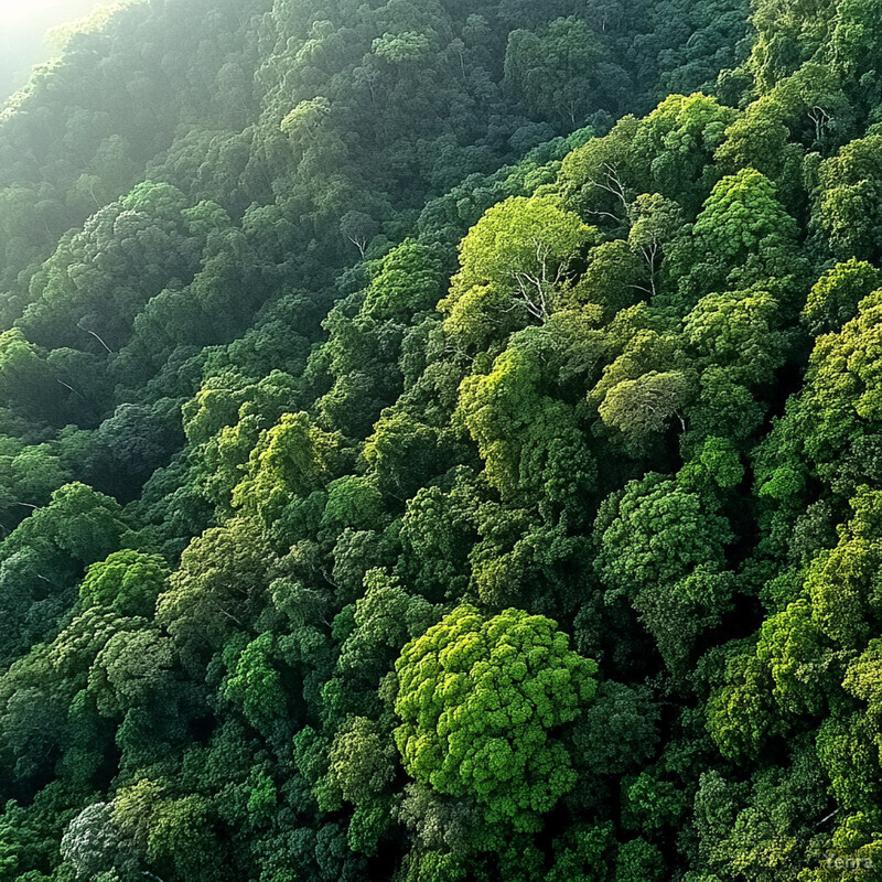
10. Forest Inventory and Biomass Estimation
Forest inventory gets stronger when AI turns repeated aerial and lidar capture into actual structure estimates such as height, diameter, crown metrics, and biomass. The key shift is from coarse stand summaries toward more continuous structural monitoring.

A 2025 Scientific Data release mapped canopy height and above-ground biomass across the Iberian Peninsula using a deep-learning framework that fused Sentinel-1, Sentinel-2, and lidar. ISPRS Archives 2025 also described under-canopy UAV path planning for LiDAR-based DBH estimation, directly targeting one of the most practical inputs in forest inventory. Inference: aerial forest analytics are becoming more useful because AI is helping bridge open regional biomass maps with more detailed local structural measurements.
11. Habitat and Biodiversity Assessment
Habitat assessment is strongest when imagery supports ecological classification that is spatially explicit, updateable, and sensitive to structure as well as cover. AI helps most when it scales habitat mapping without flattening biologically meaningful differences.

A 2025 Scientific Data paper introduced machine-learning-based EUNIS habitat maps with improved thematic and spatial resolution for Europe. In the same year, a ScienceDirect study used EnMAP hyperspectral imagery and deep learning for terrestrial habitat mapping in arid landscapes, demonstrating how hyperspectral imaging can add habitat discrimination beyond ordinary RGB. Inference: habitat mapping is getting stronger because AI can increasingly combine detailed land-cover structure with spectral material cues instead of treating biodiversity assessment as a coarse vegetation-label problem.
12. Precision Ranching and Livestock Tracking
Aerial livestock monitoring is strongest when AI makes herd review less intrusive and more scalable. The value comes from repeated, non-contact measurement of animals and grazing systems rather than from one-off counting demos.
A 2025 Scientific Data release used UAV-based LiDAR and RGB data to monitor growth of 96 semi-free-range beef cattle, providing a richer structural dataset for precision livestock work. Then in February 2026, Computers and Electronics in Agriculture published a deep-learning UAV framework for automated morphological and growth analysis of feedlot cattle, showing 112 days of longitudinal monitoring and three biological growth phases. Inference: aerial livestock analytics are getting more credible because they are moving from pure detection toward continuous morphometric monitoring.
13. Legal Compliance and Enforcement
Compliance monitoring is strongest when AI helps turn imagery into timely evidence of emissions, encroachment, disturbance, or restoration gaps. The hard part is not seeing from above. It is deciding what counts as reviewable, actionable, and defensible evidence.

NASA's updated EMIT greenhouse-gas portal explains how methane and carbon dioxide have distinct shortwave-infrared fingerprints that can be mapped from imaging spectroscopy. NIST's 2025 guidance on quantifying methane emissions from remotely sensed plumes shows how plume interpretation is becoming more standardized and reviewable. Inference: aerial enforcement is getting stronger when AI-based detection is paired with clearer measurement practices instead of being treated as a black-box accusation engine.
14. Soil Erosion and Sedimentation Modeling
Erosion modeling improves when imagery is used to map susceptibility, track disturbance, and target mitigation rather than simply produce a generalized erosion-risk layer. AI is strongest here when it helps land managers see where slope, cover, and soil condition are combining into actual vulnerability.
An Agronomy paper published in March 2026 mapped soil erodibility in the Northern Adana region using machine learning and remote-sensing data fusion, focusing directly on spatial K-factor prediction. A 2025 Environmental Systems Research study similarly used machine-learning-based digital soil mapping to estimate soil-erodibility indices under different land uses. Inference: aerial erosion work is improving because AI can now combine terrain, cover, and soil covariates into more spatially explicit susceptibility layers instead of relying only on coarse rule-based assumptions.
15. Cultural Heritage Site Protection
Heritage protection becomes stronger when aerial imagery is used for continuous documentation and change review, not just for scenic visualization. AI helps when it can speed up site documentation, reveal subtle disturbance, and support climate-risk monitoring for vulnerable landscapes.
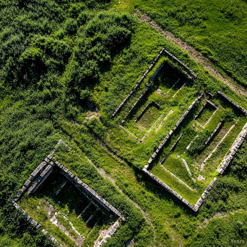
A 2025 Field Archaeology paper showed how RPAS photogrammetry and LiDAR can document archaeological sites in Nunavik threatened by coastal hazards, fire, and shrubification. A separate 2025 ScienceDirect article on documenting drone remote sensing proposed more explicit, reality-based modeling workflows for cultural heritage and archaeology. Inference: heritage protection is getting stronger when aerial capture produces reusable spatial records rather than disconnected visual outputs.
16. Carbon Sequestration Monitoring
Carbon monitoring is strongest when AI uses aerial and orbital imagery to estimate structural change that can actually support forest and restoration decisions. The important shift is from occasional carbon claims toward repeatable canopy-height and biomass evidence.
The 2025 Iberian Peninsula canopy-height and biomass dataset showed how Sentinel and lidar fusion can produce high-resolution structural carbon proxies across large forest areas. Earth System Science Data then published annual 30 m above-ground biomass mapping for China from 1985 to 2023, extending carbon monitoring into long time horizons. Inference: AI is making carbon monitoring more useful when it supports both local project verification and long-term regional trend analysis.
17. Mine Reclamation and Environmental Compliance
Mine-land monitoring gets stronger when aerial imagery tracks restoration trajectories instead of only flagging bare ground. AI helps most when it can separate active disturbance, partial recovery, and more mature reclamation outcomes across time.
USGS Circular 1525 in 2024 laid out remote sensing as a practical tool for monitoring mine lands and recovery efforts, including vegetation recovery and disturbance extent. A 2025 Remote Sensing paper on coal mining and reclamation used multitemporal imagery with a U-Net architecture to classify mining and reclamation areas more effectively across seasons. Inference: aerial mine compliance is moving toward longer-horizon recovery monitoring rather than simple before-and-after image review.
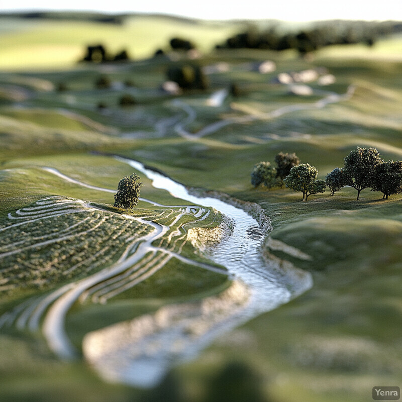
18. 3D Terrain Modeling and Landscape Analysis
3D landscape analysis is strongest when AI helps turn overlapping imagery into survey-ready orthomosaics, surface models, and terrain reconstructions quickly enough to matter. The real gain is fewer delays between capture and usable elevation or structure data.

ISPRS Annals 2025 described a robust near-real-time approach for seamless orthomosaic generation using off-the-shelf UAVs for ultra-high-resolution mapping. A 2024 Geographies paper on real-time 3D terrain reconstruction from aerial imagery likewise focused on automated reconstruction and path planning for fast point-cloud generation. Inference: aerial land-management workflows are getting stronger because 3D products are increasingly produced as part of live operations rather than long-delayed post-processing.
19. Infrastructure Damage Assessment Post-Disaster
Post-disaster aerial AI is strongest when it helps triage damage faster than manual roof-by-roof review while still leaving room for expert verification. The practical goal is rapid prioritization: where damage is concentrated, how severe it appears, and what should be inspected first.

A 2025 arXiv paper on rapid damage assessments from sUAS imagery reported operational deployment during federally declared disasters and described training on 21,716 building-damage labels together with practitioner onboarding. ESSD's 2025 Noto Peninsula earthquake building-damage dataset then expanded the benchmark base with multi-source visual assessment informed by aerial imagery. Inference: aerial damage assessment is now strong enough to serve as a real first-pass response layer, especially when paired with structured human review and good data release practices.
20. Multi-Temporal and Seasonal Pattern Analysis
Seasonal analysis gets stronger when AI learns not just what a landscape looks like, but how it behaves over time. This is where aerial and satellite land management increasingly becomes a time-series problem rather than a single-scene interpretation problem.
NASA's updated Prithvi geospatial foundation model was trained on 4.2 million global time-series samples from Harmonized Landsat and Sentinel data, reflecting how Earth observation models are now explicitly time-aware. A 2025 Environmental Data Science paper on tree semantic segmentation from aerial image time series showed that repeated aerial capture can improve forest monitoring tasks that single-image workflows handle poorly. Inference: multi-temporal interpretation is becoming one of the clearest ways AI strengthens aerial land management, especially where seasonality is informative rather than distracting.
Related AI Glossary
- Remote Sensing covers the broader practice of collecting land measurements from satellites, aircraft, and drones.
- Orthomosaic explains the stitched, georeferenced aerial base layer that underpins many mapping and inspection workflows.
- Photogrammetry connects directly to 3D reconstruction, survey outputs, and drone-derived terrain models.
- Geographic Information System (GIS) is the map-centric workspace where imagery, boundaries, and land decisions are combined.
- Change Detection explains how repeated image capture becomes actionable evidence of disturbance, growth, erosion, or recovery.
- Multispectral Imaging matters for crop vigor, water stress, shoreline, and vegetation-condition mapping.
- Hyperspectral Imaging adds stronger material and vegetation discrimination for habitat, contamination, and invasive-species work.
- LiDAR is central when canopy height, terrain shape, and structural measurements matter more than RGB texture alone.
- Crop Classification covers one of the most practical time-series tasks in land-focused aerial analytics.
- Evapotranspiration (ET) links imagery to practical irrigation and crop-water decisions.
Sources and 2026 References
- NASA Science: Expanded AI Model with Global Data Enhances Earth Science Applications.
- Scientific Data: A high-resolution land cover map of Southern California from aerial imagery.
- Remote Sensing: Land Cover Classification via Very High-Resolution Topographic Map Extraction from Aerial Imagery.
- Scientific Reports: Land use classification using multi-year Sentinel-2 images with deep learning ensemble network.
- ScienceDirect: Change detection in Sentinel-2 images using deep learning ensembles.
- arXiv: CropSTS: Foundation Models Can Outperform History in Crop Type Segmentation.
- Frontiers in Agronomy: Integrating UAVs, satellite remote sensing, and machine learning in precision agriculture.
- ISPRS Annals: Advances in Precision Farming: a contribute for estimating crop health and water stress by comparing UAV Multispectral and Thermal Imagery.
- Computers and Electronics in Agriculture: RGB-to-synthetic-thermal image translation using generative AI to support crop water stress assessment.
- Land: Integrating Sentinel-1 SAR and Machine Learning Models for Optimal Soil Moisture Sensor Placement at Catchment Scale.
- Crop Science Society of America: Site-specific irrigation and turfgrass quality using UAS imagery.
- NASA Earth Observatory: Wildfire Maps Help Firefighters in Real Time.
- Scientific Reports: Global lightning-ignited wildfires prediction and climate change projections based on explainable machine learning models.
- Sustainable Geoscience: Portugal coastal erosion monitoring system using unmanned aerial vehicles and aerial photogrammetry.
- EGUsphere: Rapid Flood Mapping from Aerial Imagery Using Fine-Tuned SAM and ResNet-Backboned U-Net.
- ISPRS Annals: Phenological and Species-Level Classification of Aquatic Invasive Plants Using UAV Multispectral Imagery and Machine Learning.
- Smart Cities: Multi-Sensor AI-Based Urban Tree Crown Segmentation from High-Resolution Satellite Imagery for Smart Environmental Monitoring.
- ICC 2025: Building footprint extraction using National Agriculture Imagery Program and 3DEP data.
- Scientific Data: Canopy height and biomass distribution across the forests of Iberian Peninsula.
- ISPRS Archives: Under-Canopy UAV Global Path Planning for Tree DBH Estimation Using LiDAR.
- Scientific Data: EUNIS habitat maps: enhancing thematic and spatial resolution for Europe through machine learning.
- ScienceDirect: Harnessing hyperspectral imaging and deep learning for terrestrial habitat mapping in arid landscapes.
- Scientific Data: Integrated unmanned aerial vehicle-based LiDAR and RGB data for individual cattle growth monitoring in precision livestock farming.
- Computers and Electronics in Agriculture: Deep learning-based UAV framework for automated morphological and growth analysis of feedlot cattle.
- NASA/JPL EMIT: Greenhouse Gases | EMIT Open Data Portal.
- NIST: Common Practices for Quantifying Methane Emissions from Plumes Detected by Remote Sensing.
- Agronomy: Mapping Soil Erodibility Using Machine Learning and Remote Sensing Data Fusion in the Northern Adana Region, Turkiye.
- Environmental Systems Research: Digital mapping of soil erodibility factor in response to land use change using machine learning models.
- Field Archaeology: Remotely Piloted Aircraft Systems (RPAS) for Monitoring Archaeological Sites in Nunavik in the Face of a Changing Climate.
- ScienceDirect: Documenting drone remote sensing: a reality-based modelling approach for applications in cultural heritage and archaeology.
- ESSD: Dynamics of China's forest carbon storage: the first 30 m annual aboveground biomass mapping from 1985 to 2023.
- U.S. Geological Survey: Remote sensing for monitoring mine lands and recovery efforts.
- Remote Sensing: Multitemporal Spatial Analysis for Monitoring and Classification of Coal Mining and Reclamation Using Satellite Imagery.
- ISPRS Annals: A Robust Integrated Approach for Near Real-Time Seamless Orthomosaic Generation Using Off-the-Shelf UAVs for Ultra-High Resolution Mapping Applications.
- Geographies: Towards Real-Time 3D Terrain Reconstruction from Aerial Imagery.
- arXiv: Deploying Rapid Damage Assessments from sUAS Imagery for Disaster Response.
- ESSD: The 2024 Noto Peninsula earthquake building damage dataset: multi-source visual assessment.
- Environmental Data Science: Tree semantic segmentation from aerial image time series.
Related Yenra Articles
- Geospatial Analysis covers the map-based decision layer that gives aerial outputs operational meaning.
- Satellite Data Analysis for Agriculture extends many of the same crop and land-cover workflows from local imagery to broader monitoring programs.
- Autonomous Infrastructure Inspections focuses on one of the most practical inspection uses for aerial AI systems.
- Environmental Impact Assessments shows how aerial evidence becomes part of regulated land and environmental review.
- Natural Habitat Restoration follows the monitoring side of land management into mitigation and recovery work.