Ocean exploration gets more useful when AI shortens the path from sonar, satellites, underwater robots, imagery, and acoustics to decisions scientists and operators can actually use. The strongest systems are not just clever models. They are operational workflows that help teams map the seafloor faster, review imagery sooner, find organisms during missions instead of after them, and keep expensive equipment working in harsh marine conditions.
In practice, that means combining onboard autonomy, bathymetry, remote sensing, bioacoustics, sensor fusion, edge computing, digital twins, predictive maintenance, and teleoperation. That mix helps ocean teams move beyond isolated dives or cruises toward persistent, multimodal observing and more disciplined decision support.
This update reflects the field as of March 17, 2026 and leans on NOAA Ocean Exploration, MBARI, FathomNet, Allen Coral Atlas, Seabed 2030, ESA, MIT, the Met Office, the Bureau of Meteorology, and recent peer-reviewed research. Inference: the biggest gains are coming from better autonomy, better data triage, better seafloor and habitat baselines, and better integration of robotics with environmental intelligence, not from AI replacing ocean science.
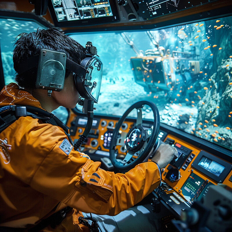
1. Autonomous Underwater Vehicles (AUVs)
AUVs become much more valuable when they can make bounded local decisions instead of only following a preloaded route. AI is strongest here when it helps vehicles adapt sensing, prioritize observations, and operate productively despite limited bandwidth and slow human oversight.
-2.jpg)
NOAA Ocean Exploration's current Deployable AI work shows where autonomy is heading: during dives, detector and supervisor algorithms review live video and look for animals they have been trained to recognize, helping teams identify fish, jellyfish, siphonophores, and comb jellies without waiting for post-cruise review. NOAA's broader AI overview makes the operational reason clear: remotely operated and autonomous vehicle dives can last for many hours or even days, so automatic labeling and prioritization can materially increase exploration efficiency. Inference: AUV autonomy is shifting from route execution toward mission-level triage and adaptive sensing.
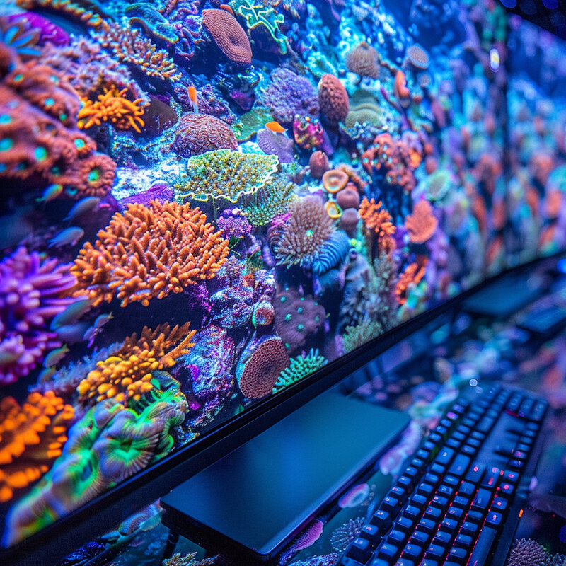
2. Data Analysis and Interpretation
Ocean data analysis is now limited less by collection than by review. AI matters because ships, observatories, and robots generate more video, sonar, and sensor streams than experts can inspect manually, so the best systems reduce backlog rather than just adding more raw data.

MBARI and its partners are building exactly this kind of review stack. FathomNet says its database now includes over 100,000 images with contributions from more than 800 people across 101 countries, while the FathomVerse game reached 13,000 downloads in its first six months and generated more than 6.6 million annotations. The point is not novelty. It is throughput: FathomNet's stated goal is to accelerate the analysis of ocean visual data by connecting machine learning and community annotation to the backlog problem. Inference: strong ocean AI increasingly depends on shared data infrastructure and human-in-the-loop labeling pipelines, not only on larger models.
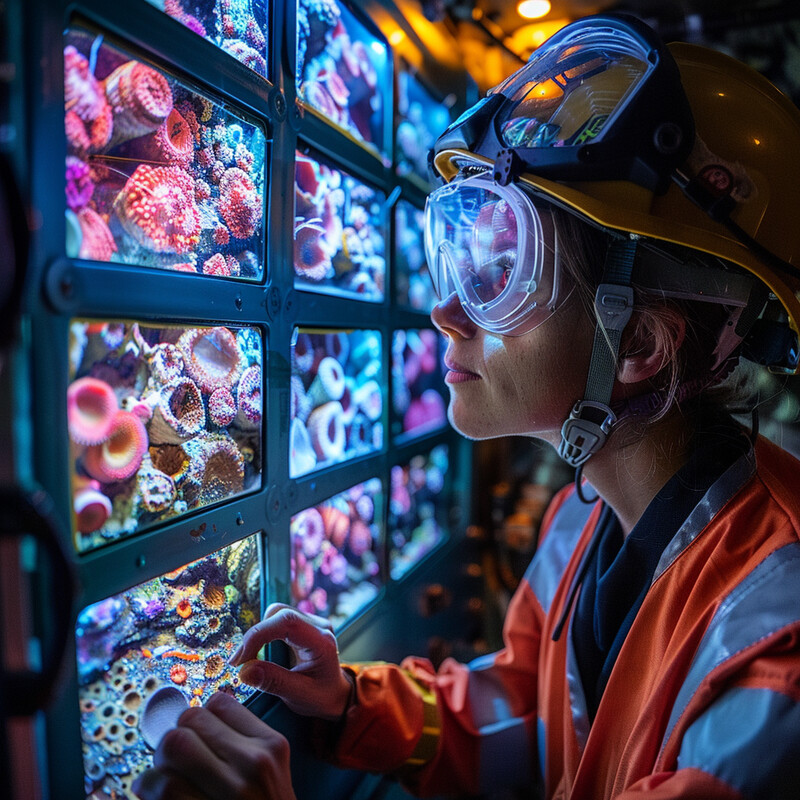
3. Habitat Mapping
Habitat mapping improves when AI helps merge satellite, sonar, and vehicle data into repeatable spatial baselines. For the ocean, that usually means better coral habitat products near the surface and better bathymetry and seafloor structure at depth.
Allen Coral Atlas has now completed version 2 geomorphic and benthic habitat maps for shallow coral reefs globally, giving conservation teams a far more standardized remote-sensing baseline than earlier reef products. At the seafloor scale, Seabed 2030's February 3, 2025 Arctic update added 1.4 million square kilometers of modern mapping coverage, while the project's June 2025 milestone reported that 27.3% of the global seafloor had been mapped to modern standards. Inference: AI-backed habitat mapping is strongest when it turns imagery and sonar into continuously improvable public baselines rather than one-off maps.
4. Species Identification and Tracking
Species identification is becoming more useful because AI can now help during missions, not just after them. That matters in the ocean, where visibility, dive duration, and review burden make it easy for important observations to remain buried in video or audio archives.
NOAA's Deployable AI project is explicitly built to find and identify marine life from live exploration video in near real time, while a 2025 fish-sound study from Woods Hole Oceanographic Institution showed that neural networks could identify fish presence on coral reefs from audio with human-level accuracy more than 25 times faster than manual review. The authors argue that the model could eventually support real-time reef monitoring on moorings, AUVs, or fixed stations. Inference: marine species detection is moving from post-expedition annotation toward persistent sensing that combines vision with bioacoustics.
5. Pollution Monitoring
Pollution monitoring gets stronger when AI can screen large ocean areas quickly and then hand higher-confidence incidents to experts. In marine settings, that increasingly means combining satellite anomaly detection with in-water sensing instead of relying on one surveillance layer alone.
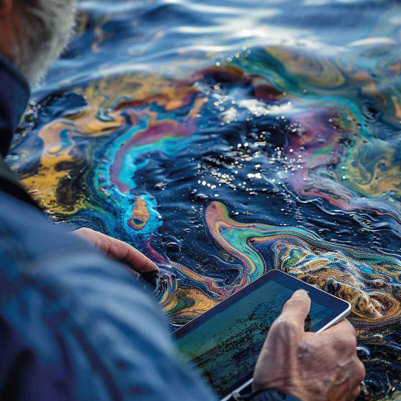
ESA's current marine anomaly-detection app for Phi-sat-2 is a strong example of edge screening from orbit: it scores maritime images for departures from normal water state, can trigger alerts for oil spills, harmful algal blooms, or sediment discharges, and prioritizes which scenes get downloaded first. Closer to the water, the 2024 SEAGULL system showed that low-cost in-situ AI sensing could distinguish main underwater plastic categories with over 85% accuracy under real field conditions. Inference: pollution AI is becoming more operational because it now works both in orbit and in the water, reducing the gap between detection and response.
6. Climate Change Research
AI in ocean-climate research matters most when it produces forecasts and emulators people can actually use for marine heatwaves, currents, and regional conditions. The strongest work now complements physics-based models instead of pretending to replace them.

Two recent operational examples show the shift. Australia's Bureau of Meteorology launched new long-range marine heatwave forecasts on December 15, 2025, giving users a dedicated service for one of the clearest ocean climate risks. The Met Office's 2025 MaLCOM work then showed that an AI model could forecast Gulf of Mexico currents from a laptop, enough for the agency to frame it as a tool for marine operational decision-making. Inference: useful ocean-climate AI is increasingly about lower-cost, faster services that slot into planning workflows rather than only academic hindcasts.
7. Deep-sea Mining Exploration
Deep-sea mining exploration is one of the areas where stronger AI should reduce uncertainty, not just accelerate extraction. The most defensible uses today are image analysis, environmental baseline mapping, and resource estimation in places where manual review is slow and ecological stakes are high.
Recent primary work is pointing toward this more cautious role. A 2025 Journal of Marine Science and Engineering paper evaluated deep-learning models for polymetallic nodule detection and segmentation in seafloor imagery, while a 2025 Ecological Informatics paper developed BM-YOLO for automated recognition of deep-sea benthic megafauna in polymetallic nodule mining areas. Inference: the strongest AI contribution here is likely to be better environmental baseline mapping and more transparent survey interpretation before any claim of "smarter mining" is taken seriously.
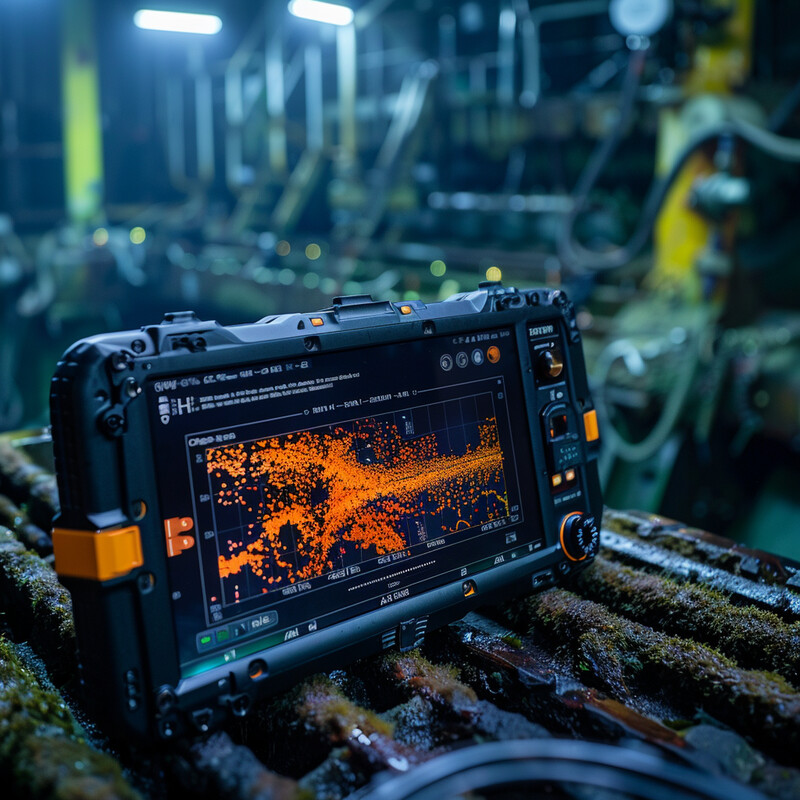
8. Predictive Maintenance for Exploration Equipment
Ocean exploration equipment is expensive, remote, and difficult to repair mid-mission, which makes predictive maintenance unusually valuable. The best systems couple inspection analytics with digital models so teams can intervene before a mission fails.

A 2025 Ocean Engineering paper proposed a framework for planning underwater hull inspections based on computer vision and degradation assessment, explicitly linking automated damage detection to inspection scheduling. MIT AeroAstro's 2025 PEARL work extends the same logic offshore through a predictive thermal digital twin for a renewably powered AUV servicing platform designed to extend vehicle range and endurance. Inference: predictive maintenance in ocean exploration is getting stronger because inspection, condition assessment, and system modeling are being tied together instead of handled as separate chores.
9. Communication Enhancement
Communication enhancement matters because underwater robotics still lives under severe bandwidth and latency limits. AI is most useful here when it improves channel estimation, modulation choice, and signal classification enough to make sparse links more reliable rather than pretending the physics problem has disappeared.
A 2025 systematic review in Electronics concluded that machine learning and deep learning are improving underwater acoustic communication through better channel estimation, adaptive modulation, and modulation recognition, citing throughput gains of 25% and meaningful BER reductions in recent studies. A 2025 paper on multi-node channel quality estimation then showed how deep learning can help an AUV gather data more efficiently from distributed sensor nodes. Inference: the practical role of AI in underwater communications is to make low-bandwidth links more usable for exploration and monitoring, especially when combined with edge computing and smarter mission planning.
10. Enhanced Safety Protocols
Enhanced safety in ocean exploration usually comes from bounded autonomy, hazard awareness, and better human-robot coordination rather than vague promises about AI foresight. The strongest systems reduce collision risk, improve navigation in constrained spaces, and keep operators legibly in the loop.
A 2025 demonstration paper on CavePI showed autonomous exploration of underwater caves by semantic guidance, which is exactly the kind of high-risk, low-visibility environment where safety depends on combining perception and bounded autonomy. A 2025 sim-to-real study in Robotica similarly focused on autonomous obstacle avoidance for underwater vehicles, highlighting the need to transfer safety-relevant behavior from simulation to field conditions. Inference: AI safety gains in ocean exploration are increasingly grounded in collision avoidance, constrained navigation, and human-supervised autonomy rather than generic maritime risk dashboards.
Sources and 2026 References
- NOAA Ocean Exploration: Artificial Intelligence
- NOAA Ocean Exploration: Deployable Artificial Intelligence for Exploration and Discovery in the Deep Sea
- FathomNet: About
- FathomNet: FathomVerse Levels Up Ocean Exploration
- Allen Coral Atlas
- Ocean Decade: New Arctic Ocean map marks key milestone in global seafloor mapping
- Ocean Decade: Seabed 2030 announces new seafloor data on World Hydrography Day
- AIP Publishing: 'Fishial' recognition - neural network identifies coral reef sounds
- ESA: AI for marine anomaly detection
- ESA: Phi-sat-2 begins science phase for AI Earth images
- IoTDI 2024: SEAGULL - Low-Cost Pervasive Sensing for Monitoring and Analysing Underwater Plastics
- Bureau of Meteorology: New marine heatwave long-range forecasts
- Met Office: AI model could revolutionise marine operational decision-making
- Scientific Reports: OceanNet - a principled neural operator-based digital twin for regional oceans
- Journal of Marine Science and Engineering: Evaluation of Deep Learning Models for Polymetallic Nodule Detection and Segmentation in Seafloor Imagery
- Ecological Informatics: Automated recognition of deep-sea benthic megafauna in polymetallic nodule mining areas based on deep learning
- Ocean Engineering: A framework for planning underwater hull inspections based on computer vision and degradation assessment
- MIT AeroAstro: Predictive thermal digital twin model for a renewably powered offshore AUV servicing platform
- Electronics: Toward Intelligent Underwater Acoustic Systems: Systematic Insights into Channel Estimation and Modulation Methods
- Computer Standards & Interfaces: Deep-learning based multi-node channel quality estimation for underwater acoustic communications
- RSS 2025: Demonstrating CavePI - Autonomous Exploration of Underwater Caves by Semantic Guidance
- Robotica: Autonomous underwater vehicles obstacle avoidance - a sim-to-real validation for reinforcement learning-based navigation
Related Yenra Articles
- Animal Tracking and Conservation shows how marine discovery intersects with wildlife monitoring and protected-species response.
- Bioacoustics Research Tools adds acoustic sensing and AI review pipelines for underwater species and soundscapes.
- Water Quality Monitoring connects ocean sensing to pollution, nutrients, harmful algal blooms, and aquatic health.
- Environmental Monitoring broadens ocean sensing into larger climate, land, atmosphere, and ecosystem intelligence.
- Climate Adaptation Strategies shows how ocean forecasts and marine hazard intelligence support planning decisions.
- Geospatial Analysis adds the mapping, fusion, and spatial modeling logic behind seafloor and habitat products.