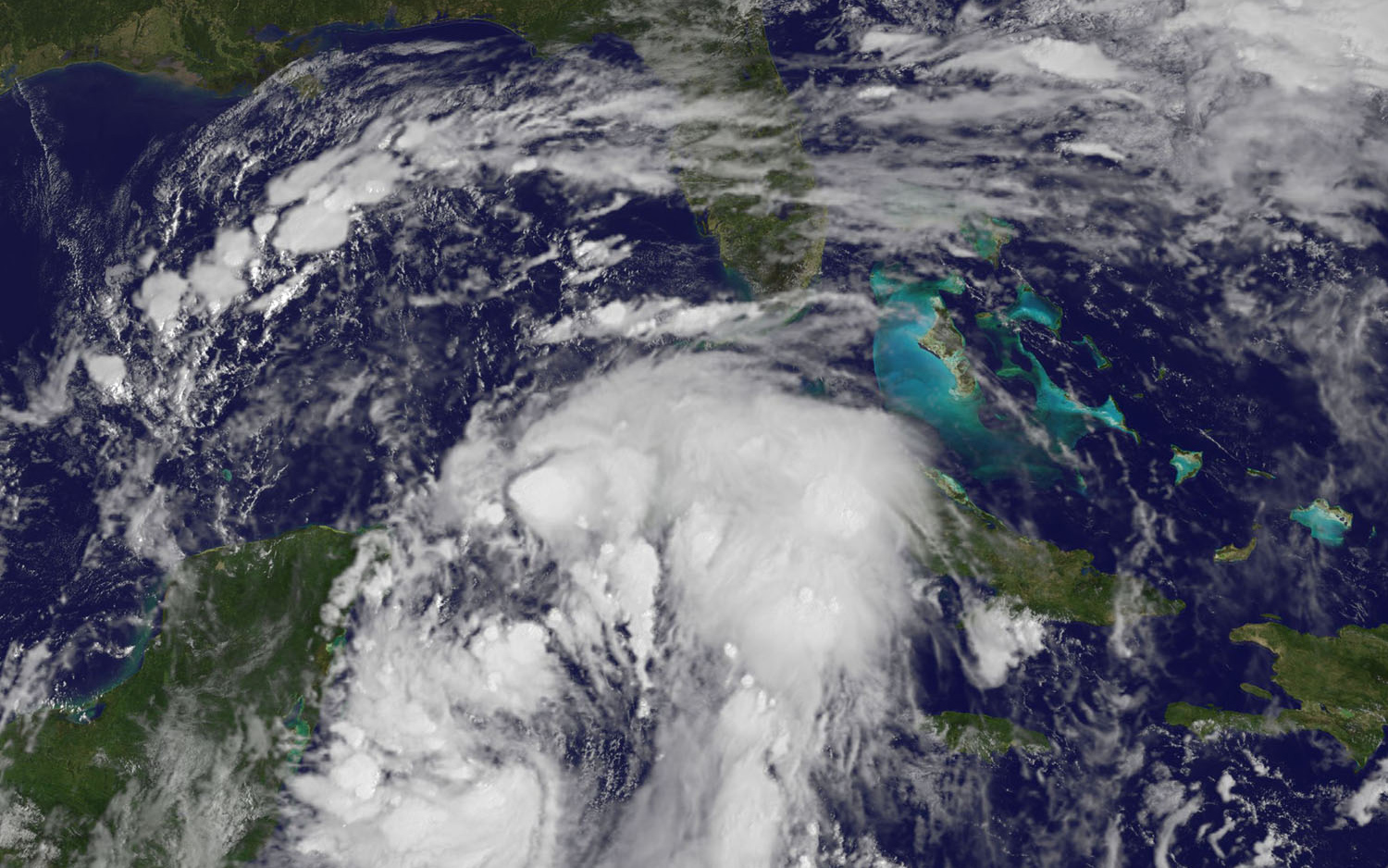
On October 6, 2017 at 10 a.m. EDT, NOAA's GOES East satellite provided a visible image of Nate that showed the center back over water in the northwestern Caribbean Sea. Powerful thunderstorms circled the center and east of the center.
Heavy rainfall will occur over a wide area, including locations well away from the center along the Pacific coast of Central America. Rainfall across all of these areas may produce life-threatening flash floods and mudslides.
The National Hurricane Center noted that Nate is expected to produce the following rain accumulations through the weekend of Oct. 7 and 8: Southern Honduras and western Nicaragua can expect 6 to 10 inches, maximum 15 inches; eastern El Salvador and northern to central Honduras can expect between 3 to 5 inches, maximum 8 inches; eastern Yucatan and western Cuba can expect 2 to 4 inches, maximum 8 inches; eastern Belize and the Cayman Islands can expect between 1 to 3 inches. Along the U.S. Central Gulf Coast states: 3 to 6 inches, maximum 12 inches.
In the U.S., a Storm Surge Watch is in effect for Morgan City, Louisiana to the Alabama/Florida border and for the northern and western shores of Lake Pontchartrain, Louisiana. A Hurricane Watch is in effect for Morgan City, Louisiana to the Mississippi/Alabama border, metropolitan New Orleans, Lake Pontchartrain and Lake Maurepas and in Mexico from Punta Herrero to Rio Lagartos.
A Tropical Storm Watch is in effect from the Mississippi/Alabama border to the Okaloosa/Walton County Line and west of Morgan City to Intracoastal City, Louisiana.
As of October 6, maximum sustained winds are near 45 mph with higher gusts. Strengthening is forecast during the next couple of days, and Nate is expected to become a hurricane by the time it reaches the northern Gulf of Mexico. The minimum central pressure estimated from the Hurricane Hunter data is 996 millibars.
On Friday, the National Hurricane Center said "On the forecast track, the center of Nate will move across the northwestern Caribbean Sea today, and reach the eastern coast of the Yucatan peninsula early this evening. Nate will then move into the southern Gulf of Mexico tonight and approach the northern Gulf coast Saturday evening."